
Another interesting thing about this whole area of Colorado is the weather. Apparently, the monsoons that affect Arizona and New Mexico come this far north. Every morning starts out without a cloud in the sky, but soon after noon, the clouds start building and by 3:00 pm it is raining. In fact, in this high desert, it has rained every single day for the last week!

Thanks to my friend, Jill, for reminding me about the Colorado National Monument. I had stayed in Fruita a couple of weeks ago, but did not have time to see this place. Since I had gotten to Fruita early today, I got set up with a campsite and then headed for this really gorgeous place. You enter at one end and drive about 30 miles to the other end, along the bluff. The "rim" is the edge of this high mesa.

I stopped right after going through the entrance booth to take some photos and look at the brochures I had been given.

Started to climb to the top of the mesa.

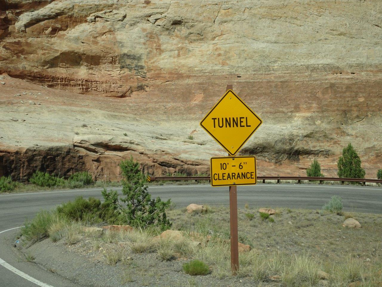
There had been a big sign just before the entrance warning about 10'8" tunnels, but the ranger lady said to ignore them. Apparently, the tunnels are 16; high in the middle. The lower number is the edge of the pavement. All I had to do was drive over the yellow lines and watch for traffic coming towards me. Easy.

Halfway up and terrific view of the town below! I got out my "super-chock" and put it behind one tire as I did not trust Park or my emergency brake. I could imagine all my belongings rolling off the edge! No guard rails along this drive.


The road follows the rim trail, which follows the contour of the many side canyons. This is the road I had driven up.

And the roads, tunnels, and everything else up here was built by the Civilian Conservation Corps young men in the 30s. You can look in any national park or monument from that time and see all the incredible work they did for $30 a month! And they only got to keep $5 of that as the rest was sent to their parents back home to support their families during the Depression.

There is also a visitor center up here and a couple of campgrounds. No electric, so I would like to come back here in much cooler weather. (It was 99 degrees today in Fruita.)

Another canyon and a rock spire you can climb, should you be in the mood and a lot younger than I am! It's bigger than it looks, as you can tell if you look at the bottom and the scrub bushes and pinion pine at its base.


I don't think this low rock wall would keep any vehicles from going over the edge.

Finally heading down.


I was so busy taking a photo of the warning sign that I missed taking a photo of the entrance to the tunnel.

You can see the mesa tops where I had just come from.

I spent 2.5 hours driving this and then headed back to my campground. I will come back here some day in the fall or spring and try out the campground.
No comments:
Post a Comment