Wednesday, January 31, 2024

1/31 J.N. "Ding" Darling National Wildlife Refuge

I had not been to Sanibel Island and the Ding Darling Wildlife Preserve for several years, so I chose today to go there.  It was a cool, but sunny day, so I knew I would not bake or freeze while riding my bike.  

If you remember, Sanibel Island was almost completely destroyed in September 2022 by Hurricane Ivan.  The only access to the island, the bridge, was inaccessible for a month because the causeway where the bridge stands was cut in a couple of places, as shown here:  https://www.npr.org/2022/09/30/1126204141/sanibel-causeway-hurricane-ian    Most people had evacuated, but those who stayed had to be ferried off, and many homes, nearly all cars, and most businesses were destroyed.  It has been 18 months, and there is still a lot of construction going on, but from what I saw driving in and out, at least 50-60% of businesses were still not open. 

Here are some photos of the entrance to the bridge and some of the construction still happening on the causeway to rebuild some beaches and fishing areas:

Eventually, you will be able to pull off the roadway and enjoy the picnic, fishing, and swimming areas again.


Notice the damage to trees.  Normally, there would be taller trees and more of them.

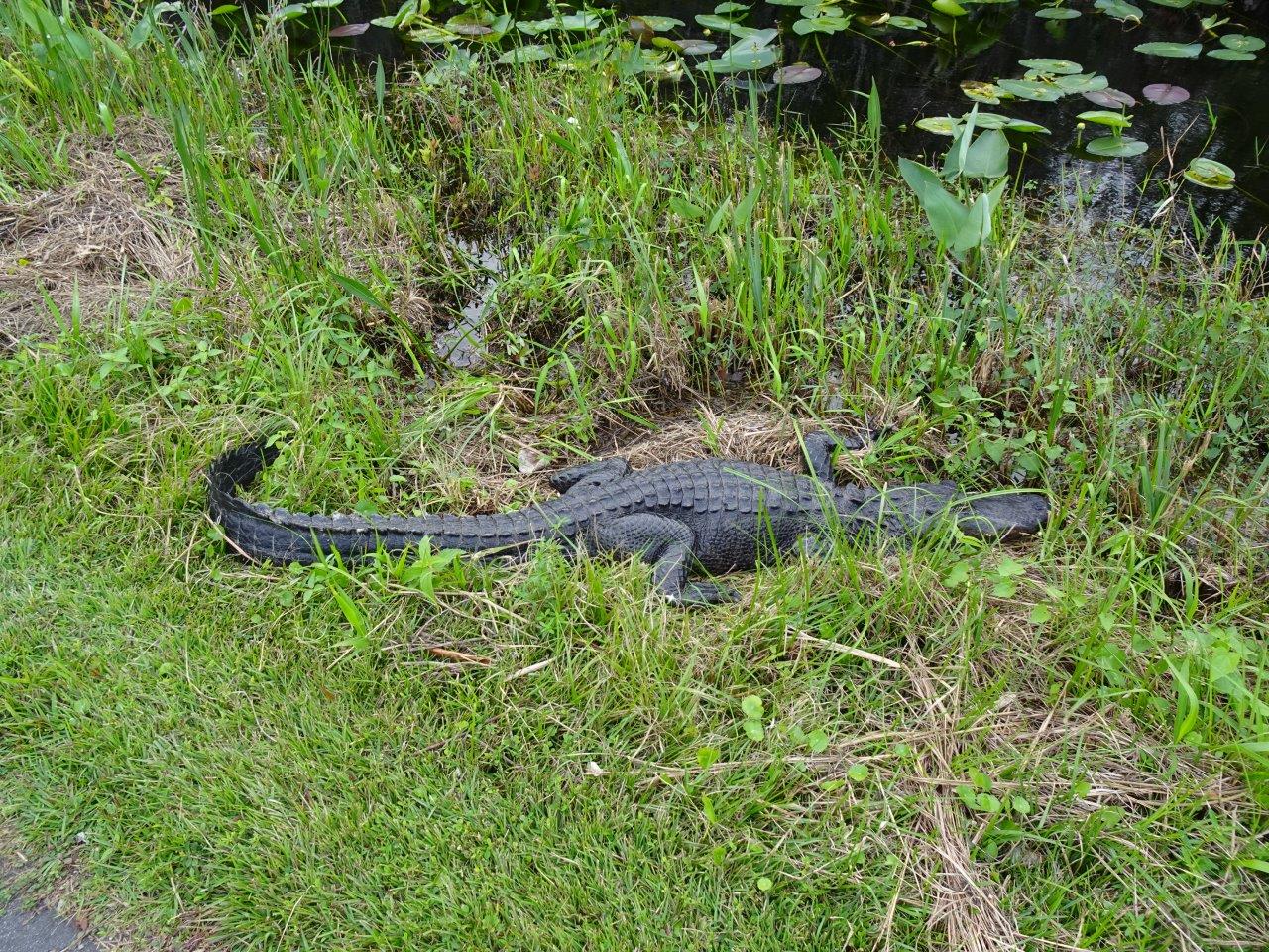
In any case, I always enjoy riding my bike and seeing birds at Ding Darling.  The preserve consists of several areas of wetlands and large tidal ponds and cypress forests where birds congregate.

This is a good map of the area.  I rode around the entire paved roadway, for a total of 9 miles.  Not bad for an old lady! 

They have a very nice visitor center, and I treated myself to a t-shirt and a tea towel with birds on it!

As you can see, some areas of the parking lot and the grounds near the visitor center are still being worked on.

This is the beginning of the 4.5 mile roadway that goes through the refuge.  It is one-way, so you exit at the far end and either drive back on the main road or ride your bike on the path along it.  I was surprised by the bare and broken trees.

Looks pretty sad.  These are dead trees, not trees that have just lost their leaves for the winter. 

This is the first time I have seen a reddish heron.  It looks a lot like a great blue heron, but it has a reddish neck. 

And a little blue heron, identified by its black and grey beak and small body size.

A flock of American white pelicans resting on a sandbar. 

More dead trees.  At least the birds are still nesting in some of them.


This is a juvenile white ibis. 

And some of his/her siblings on a nearby branch!  These birds are extremely common in Florida and can often be found anywhere there is water.

Don't know if you have ever seen one of these, but it is a container to put broken fishing line, hooks, and lures in so birds do not get caught up in them. 

And last, but not least, is a yellow-crowned night heron.  Normally, you would be able to see his long neck, but a lot of birds scrunch their long necks down when they rest.  You can see part of his long legs under the branch in front of him.


The only big problem with visiting Sanibel Island, both now and in the past, is the lack of a second exit.  Late the the day, you can wait up to an hour or more to get off the island.  It was worse before the hurricane destroyed a lot of restaurants, but just be aware that you should try to leave before 3:00 pm or wait until after the late afternoon rush hour.  I left the refuge at 4 pm and it took me over an hour of stop and go traffic to drive the last 3.7 miles to the bridge.  Once you get on the bridge, you are usually pretty clear. 


Saturday, January 27, 2024

1/27 Visiting Michigan--the Great Lakes State

I am back at WP Franklin campground, and I posted about this place in December, so I am not going to bother posting again now.  However, I have decided to use this time to post about some things that people ask me about fairly often.  The first is what to see and do in Michigan, which is where I was born and spent my entire life until about 12 years ago.  I also got degrees from two of the major Universities there, and taught in one smaller college part-time for 30 years.  Also, I still have a niece, a few cousins, and many friends there, so I make sure I go there for a few days to visit people and to stock up on Michigan food and t-shirts!!  

Many people are not familiar with Michigan because it is not on the way to anyplace else.  In other words, unlike like most states, you don't go through it to head out west or east or even south.  It IS a short cut to Canada, but a lot of people do not do much traveling there.  This is a shame because Michigan consists of two large peninsulas and borders of four of the five world's largest fresh-water lakes!!  In addition, Detroit is one of the oldest big cities in the U.S. and has some fantastic architectural gems, ethnic food, and great things to do and see. 

So, assuming you are entering Michigan from Indiana or Ohio, here are some places I think you should not miss as you head from the southern part of the state to what we Michiganders call "Up North."

  • Detroit Area - No longer the murder capital of the country, Detroit is overall a safe city to visit.  Did you know that Detroit was settled in 1701 as a French fur-trading post by a French explorer named Antoine de la Mothe sieur de Cadillac?  It is the oldest American city that is not along the tidal Atlantic coast. The city was originally called "le détroit du Lac Erie", or the strait of Lake Erie.  Native Americans brought furs from as far away as Lake Superior by canoe to trade here with the French.  It was surrendered to the British in 1760 and then deeded back to the French in Quebec before becoming part of the United States.  So what is there to see and do here??  Here are some of my favorites:
    • Camping Near Detroit - Frankly, there isn't any.  However, when I visit Detroit, I stay south of the city near Monroe, MI.  My favorite place is Sterling State Park on the western shore of Lake Erie.  It is open, so almost every site has a view of the lake.  Sterling State Park does have a few full- hookup sites, but if you absolutely need to have a full-hookup site, try Harbortown RV Resort. 
    • Downtown - Park in the lot just west of the big building with four towers that has a big GM sign on it.  Or you can park in the underground lot that is in the middle of Jefferson Avenue that runs along the river.  Walk over to the GM building and enjoy the shops and restaurants inside.  Check out this link for more info:  https://gmrencen.com/.  Then walk out the main doors that open towards the Detroit River and walk along the parks in both directions and enjoy the view of the river and Canada. If you are there on a weekend in the summer, there might be an ethnic festival just to the west.  (Note:  This is a unique place in the U.S. because when you look across the river to Canada, you are looking south, not north!)  
    • Belle Isle - One of the true gems of Detroit, Belle Isle is an island in the middle of the Detroit River.  This park located about two miles east of downtown and was designed by Frederic Law Olmsted, who designed Central Park in New York.  It is now a state park, so there is a fee involved, but is it worth it.  Check it out here:  https://www.belleisleconservancy.org/   When you enter, follow the outside roadway past the entrance booth and circle the island counterclockwise.  You will first see a huge fountain, Scott Memorial Fountain, so make sure you stop there and walk around.  (Also make sure you read the sign about the guy who paid to build this as a memorial to himself and what a horrible person he was!!)  hopefully, it will be spouting water.  Past the fountain, you will end up at the western point of the island with a fantastic view of downtown Detroit and Canada.  Continue driving along the perimeter road, and assuming renovation construction is completed, stop at the Anna Scripps Whitcomb Conservatory, the Belle Isle Aquarium, and the Dossin Great Lakes Museum.  Plan on spending at least a couple of hours on Belle Isle, and take some time for a picnic along the river to watch for big great lake freighters that might be going by. 
    • Detroit Institute of Arts - A world-class art museum and one of the best in the country, this is a couple of miles north on Woodward Avenue in the New Center Area.  There is underground parking for cars and a big dirt lot behind it for bigger vehicles.  Info on hours and exhibits are here:  https://dia.org/   Besides the usual things you expect to see in art museums, this one has something unique--an entire large room or covered courtyard covered with the "Detroit Industry" murals done by Mexican artist Diego Rivera in 1932-1933.  Also, something interesting to know is that when Detroit declared bankruptcy a few years ago, the plans were to sell almost $1B worth of art to pay the city's bills.  Private individuals contributed $800 million to pay the city's pension debts and to turn ownership over to an independent charitable trust and save the artwork.
    • Food -  If you had not heard it before, Detroit is a fantastic ethnic food place.  If you are downtown, take a quick drive to the Eastern Market or Greektown and enjoy the food and atmosphere!  
    • Dearborn -  One of the most interesting museums is the one set up by Henry Ford.  He focused his efforts in collecting industrial equipment and Americana.  Located in Dearborn, a large city adjacent to Detroit, the Henry Ford Museum has three parts:
      • First is the Henry Ford Museum of American Innovation itself.  Notable are many of the Presidential limousines, the bus that Rosa Parks rode in, a Ford Trimotor Plane.  Check it out here:  https://www.thehenryford.org/visit/henry-ford-museum/
      • Second is Greenfield Village.  This is an 80 acre outdoor museum containing many of the houses and businesses that Henry Ford collected.  You can ride a Model T or see the lab where Ford's good friend, Thomas Edison invented the light bulb, or walk through a farm and watch artisans create useful items.  https://www.thehenryford.org/visit/greenfield-village/
      • Finally, you can sign up for a tour of Ford's Dearborn Truck Plant and see what modern assembly looks like.  
    • Dearborn - Also in Dearborn is one of the largest Middle Eastern populations in the country.  This means some of the best Middle Eastern food in restaurants and bakeries are located in Dearborn or the Detroit areas.  Here are some suggestions for restaurants:  https://www.tripadvisor.com/Restaurants-g42130-c30-Dearborn_Michigan.html.  And if you love baklava, check out the couple dozen types at one of my favorite bakeries, Masri sweets!  
 
  • Up North - Up North is pretty hard to define in Michigan, but basically it is anywhere north of the Detroit-Ann Arbor-Flint area.  Up North is where people who live in southern Michigan go when they want to get away from it all.  Michigan has 11,000 inland lakes and 3,000 miles of Great Lakes shoreline, so you are never very far away from a place to swim or boat in.  In addition, Michigan has more lighthouses than any other states, so you can easily do a lighthouse tour, except it would take you a very long time to drive the entire Great Lakes Shoreline.  If you don't have time to do that all, here are some of my favorite places in Michigan:
    • Frankenmuth - On the way north, stop at Frankenmuth and enjoy a chicken dinner at either Zehnder's or the Bavarian inn.  Pick up some bakery goodies and bread in the basement bakeries on your way out.  Also, make a stop at Bronner's, the world's largest Christmas decoration store, even if you are there is the middle of summer!  Many small and large towns buy their town decorations from Bronner's and they also sell an amazingly large selection of tree and other ornaments you can use on your tree and home. 
    • Bay City - One of my favorite stops on my way north, after I have picked up some pastries in Frankenmuth is the :nut house", aka St. Laurent Brothers, in Bay City.  It's not a big place, and it is tucked away off the main street, but it has a great selection of candies and nuts.  https://www.downtownbaycity.com/listings/st-laurent-brothers/
    • Traverse City - This is a great city with a lot of bays and the eastern shore of Lake Michigan surrounding it.  Winds tend to flow from west to east, across Lake Michigan and the two big bays, so the climate is a bit milder than you might expect, though they do get a LOT of snow in the winter.  A slightly mild winter and early spring means it is a terrific place to grow wine grapes and sour cherries.  It is also a very cosmopolitan city with lots of restaurants and tasting rooms.  Two terrific drives are to the west or north and around the Leelanau Peninsula to the little town of Glen Arbor and to the northeast up to the tip of the Mission Peninsula.  Both of these are very scenic and full of excellent wineries.  You can also visit during the Cherry Festival in June.  Finally, you should not miss climbing on the big dune at Sleeping Bear Dunes National Park.  DO NOT attempt to climb down the dunes that overlook Lake Michigan, however, as you may not be able to climb up and will end up having to take a several mile walk to get back to level land!!!
    • Hartwick Pines State Park/Grayling - Hartwick State Park contains one of the very few tracts of virgin White Pine in Michigan, so it is well worth a visit.  The campground has some full-hookup sites, and there is a logging museum to visit, as well as a walk around the big trees.  
    • Mackinaw City - Mackinaw City is at the tip of Michigan's lower peninsula and Mackinac Island is a small island between the two peninsulas.  Both are pronounced "aw."  This may sound strange but the city was originally a British settlement and the island was a French fur trading post and fort.  I always try to stop at Mackinaw City to buy fudge and Michigan t-shirts and souvenirs.  Good fish sandwiches in the center of town also. (Warning:  Be careful about going under the bridge because some places are too low for RVs!  One of the Big Mac bridge underpasses snags about one RV per week, and it is embarrassing to have to back up through a four-way stop, even if you do stop in time, as I can attest to!) Tip:  If you are driving a large motorhome or towing a trailer, there is plenty of parking in Mackinaw City.  The main street in Mackinaw runs east and west, but one street south of this main street has a very large paved lot where you can park while you shop.  Also, there is a very pleasant park and visitor center on the shore, just underneath the bridge, with parking for RVs on the eastern side of the parking lot. You can walk along the shore or visit Fort Michilimackinac and the nearby lighthouse from that location.  Just make sure you know hot tall your RV is and check the height of any place where you choose to drive under the bridge.    
    • Mackinac Island - Mackinac Island is a very special place because of its 350 years of history and because it is unique in that no cars are allowed.  (No electric bikes are allowed either.)  You arrive by ferry or private boat and take a horse-drawn carriage to your hotel.  The island is about 70% state park, so even though millions of people visit each year, it is possible to find a quiet place to enjoy the view.  You can take your bike on the ferry or you can rent one at the boat docks.  If your hotel is close by, there are porters who will load your suitcases onto their bikes and you can walk to it.  The town on the island is small, but it has 13 fudge shops, so it is almost impossible not to buy fudge!  You can also ride your bikes or rent a self-driving horse-drawn carriage to ride around island along the 8-mile long only state highway in Michigan where cars are not allowed.  The hotels on the island are expensive, but there are smaller hotels and B&Bs available, and it is a wonderful place to spend a few days.  No camping of any kind is allowed, however.  Be sure to take an island horse-drawn tour and admire the rows of Victorian houses, plus stop at the fort.  The town area is very busy during the day, but wonderfully quiet at night after most of the "fudgies" have left.  (A "fudgie" is someone who comes just for the day and buys fudge.)
    • The Upper Peninsula - Immediately after you cross the Big Mac bridge, you will notice numerous signs advertising pasties.  A pasty is something very popular anywhere in Michigan, but especially in the UP, where it was brought by Cornish miners who came to Michigan to mine copper.  A proper pastie should consist of a pastry crust filled with equal parts chopped beef, potatoes, onions, and rutabaga, which is related to turnips but tastes slightly different.  Some people put gravy on their pasties, others put ketchup on them, but I like mine with just butter and salt.  Yum!    
    • The Soo, aka Sault Ste Marie, MI - If you keep driving north on I-75, you will arrive at the small town of Sault Ste. Marie.  (Remembering that this area was originally French, you need to know that "Sault" is pronounced "Soo.")  You are now as far north as you can go without crossing into Canada.  The St. Mary's River divides the two countries and is where the big lake freighters go between Lake Superior and Lake Huron.  The Soo Locks are fun to visit and watch big ships go through the locks.  About a mile east of the locks is the city-owned Aune Osborn Campground. It is a basic campground with water and electric sites, but is one of the best ship watching places in Michigan!!  Ships come out of the locks and need to make a slight right turn at the campground into a very narrow part of the river, so ships come close enough to wave at the workers on the decks!!  There is an online site and also a phone number you can call to know what ships are due to come through the locks and when they will arrive!    
    • Whitefish Point & Tahquamenon Falls - Heading west along the Lake Superior shore, you will find two great places to visit:  Tahquamenon Falls State Park and the Great Lakes Shipwreck Museum at Whitefish Point.  Tahquamenon Falls is the highest falls in Michigan and well worth a visit.  Whitefish Point juts into Lake Superior, and it was off Whitefish Point that the iron ore freighter Edmund Fitzgerald sank in 30' waves on November 14, 1975 with 29 souls aboard.  The wreck was found broken in half in 535' of water in 1995, and several artifacts are in the museum, including the ship's bell. If you have somehow never heard it, the official recording of the Gordon Lightfoot song about the sinking can be found here:  https://www.youtube.com/watch?v=FuzTkGyxkYI     
    • The Rest of the UP - I've hit the main points of places I like to visit in Michigan, but there are many more in the upper peninsula, including Grand Marais, Pictured Rocks National Lakeshore, the Keweenaw Peninsula, and a lot of other places, so just go Explore!!   (Note:  Even though Duluth is in Minnesota, it is on the far end of Lake Superior and a great place to end your trip.)


Thursday, January 18, 2024

1/17 Shark Valley Bike Ride

Shark Valley is part of Everglades National Park, and it is located about 15 miles from my campground, Midway, along U.S. 41, aka Tamiami Trail.  It consists of a 16-mile paved loop road that is accessible to hikers and bikes.  You can bring your own bike or rent one from the concessionaire. If you cannot ride or walk that distance, there is also a shuttle that runs every hour or so, but it's expensive, so I prefer using my electric bike.  I try to go here at least once or twice every time I visit this area in very southern Florida, but the weather has been rainy and drizzly, plus a bit chilly, over the past week that I have been camping here.  

This morning, the sun was out and no rain was expected, so I uncovered my bike, filled up the front tire with air, and headed east.  

First, since this is part of the Everglades National Park, you will need to either pay an entrance fee or show your senior pass, like the one I have.  I had to wait in line today because the parking lot is fairly small, and it was full when I arrived.  I was lucky that there was an available spot in the RV/bus parking area, but I needed help parallel parking.  Got in OK, unloaded my bike, and headed past this visitor center onto the 16-mile loop road. 


I prefer to start off on the east side of the loop because it is less crowded.  In fact, it is amazingly empty most of the time, though there was a little traffic from fellow bike riders today.  Also, note how much water there is in the Everglades.  Last time I was here a couple of years ago, it was almost dry. 


Some views of the loop and the area.  


After about 7 miles, you can see the tower in the distance.  It has a ramp and a great view of the countryside, but I skipped walking up it this year. 

 
I need to find out what this white scummy stuff is.  It looks a lot like the kind of algae that is appearing in a lot of rivers and ponds these days due to excessive farm fertilizer.  

If you are lucky, you will find several alligators sunning themselves along the roadway.  Notice that this can be identified as an alligator by its rounded snout. 

 
I mentioned the above photo as being an alligator by its rounded snout, because below is a photo of the only crocodile I have ever seen in this part of the Everglades.  I asked the rangers about it later and found out that this is a female who showed up several years ago, and seems happy just hanging around this area.  
 
She really belongs in brackish or salt water farther south with all the other crocodiles, but somehow she got here and seems comfortable staying.  She is about 8' long, so fully an adult, but she cannot mate with alligators because she is a different species. 

 
How do we know this is a crocodile, not an alligator?  The main clue is that she has a long, narrow snout and her teeth are visible on the outside of her upper jaw.  
 
Both alligators and crocodiles are equally fast in terms of swimming, but alligators are much more laid-back, while crocodile are more aggressive.  However, unless bothered, it is highly unlikely that either one will chase you as the ones do in the Crocodile Dundee movies!!!  If you find them basking in the sun, it is likely they are napping and have their eyes closed.  
 
On the other hand, almost every pond and puddle in Florida has alligators in it, so do not go swimming or even wading in any watery place in Florida or a lot of other southern states.  Stick to hotel and private pools!!  And if you go swimming even there after dark, turn some lights on and check for visitors before you dive in!  🐊 


This is a much less dangerous Florida resident.  

I came to a screeching halt when i saw this very pretty purple gallinule.  This one is looking for insects and edible vegetation.  They have very long toes on their feet, which they use for walking on vegetation, so you can often find them on pond lily pads and other floating plants.


The west loop road follows a water-filled ditch, so there are a lot more birds on it than on the eastern loop road.  You can see the ditch in this photo.

Looking ahead at some walkers over my bike.

I think this is a lance leaf arrowhead flower.

This is a swamp lily. 

And the last alligator.  Actually, there were a lot more on the trail, but I had not taken my jacket and was very cold, so I did not stop for them all. 


This is one of the best bike trails in Florida, so I strongly recommend you take it at least once or twice each year.  If I lived in Florida, I think I would go during different seasons, also.  There is always something interesting to see.


Wednesday, January 17, 2024

1/15 Midway Campground, Ochopee, FL

This is one of my favorite campgrounds in Florida, in spite of, and maybe because, it has almost no amenities.   Or at least no amenities that many people look for in a campground.  

It can clearly be said to be "in the middle of nowhere" because it is in the Big Cypress National Preserve, on Highway U.S. 41, aka Tamiami Trail, and located half-way between Miami and Naples, FL.   The nearest gas station, along with a convenience store, is located about 20 miles away in the Miccosukee Indian Reservation.  If you want a real supermarket, you need to drive about 50 miles to the Publix store in Marco Island.  

Mostly, there are just a lot of birds and alligators around this place, plus a black bear who occasionally visits the campground, so you need to keep food inside your RV or in a bear-proof storage box provided for you if you are tenting.  It is also very quiet here, especially at night when most of the highway traffic is gone.  It is also extremely dark here, as Big Cypress is a dark sky area, so you are asked to not turn on any outdoor lights at night, so fellow campers can see the Milky Way and millions and millions of stars.  

As you drive past on the Tamiami Trail, you might easily miss this campground sign.  There are other small campgrounds along this road, but this is the only one with electric hookups, so it is very popular.  


Basically, the campground is a loop that circles an alligator pond, shown below.  Alligators do come out on warm, sunny days, to increase their body temperatures so they can digest their food, which is mostly fish from the pond. 


You are asked, however, not to take pets for a walk on the grassy area between the roadway and the pond, and it is strongly suggested that you take a flashlight if you go out after dark so you do not trip over anything.  No picnicking here also, for obvious reasons.


This is my motorhome across the pond.  I took this photo on a daily walk I take around this loop.  


A closer view of my campsite.  It is paved and with both 30 and 50 amp electrical hookups.  I can easily look out my front window at any happenings around the pond. 

Mostly, I just watch birds  like this wood stork who hangs around the pond.


There is also a tent area without electric hookups.  It is empty in this photo, but most of the time it is full of tenters.  On the left side of the roadway, you can see a trailer at the water fill station, which is near the station for dumping tanks.


Almost every camping spot has a palm tree next to it, but this one has been surrounded by a strangler fig, so you cannot even see the stem. 


One interesting thing to do is to walk out to the highway and walk across to the long ditch that was created when the Tamiami Trail was created.  They needed rock and sand to build the roadway up high enough to pave, so they dug a ditch along almost the entire length of the roadway and piled up the removed material to make a road.  The result is a very long water-filled area for alligators, fish, and birds.  People also fish here. 

 
This is what this long pond looks like just on the other side of the guard railing.  The water is extremely clear and full of life.  

 
Two other views of the long ditch.  


Even though you cannot get gas or groceries nearby, there is a famous art gallery about a mile west of the campground. 

The gallery is actually the old home of Clyde Butcher, who is known as the Ansel Adams of the Everglades.  He is in his 90s now, and lives in Naples near another gallery he owns.  His art is not cheap, but it is beautiful.  You can buy a calendar or other items made by local artists.  


I had to stop and take a photo of these two little guys.   The one on the left, I think, is a Florida reef gecko.  The one on the right is a Florida scrub lizard. Unusual to get them both in one photo.

And right next to the parking lot is an alligator that you are not supposed to feed.  You are also supposed to stay at least 15' away from them. 

A closeup of this very awake fellow.