Wednesday, August 23, 2017

8/19 Drive through Lassen National Forest

I admit to being very lazy about posting lately.  I left Eagle Lake on this day and drove south to Red Bluff, CA, about halfway to Napa.  I originally planned to drive 250 miles to Napa in one day, but I had a lot of errands to run on the way, so I broke it into two days.  Needed to do some shopping and get a truck wash, among other things. 

My drive was mostly through Lassen National Forest and skimming the edges of Lassen Volcano National Park.  You can see by the hazy photos that the smoke from forest fires is still common in this area.  Can you see the third ridge of mountains in this photo? 


Behind these trees is a very big lake and some hills in the distance.  

You can barely see the far edge of the lake in this photo. 

Ah, Lassen Peak.  If I had had a little more time I could have driven only about twenty miles to get to the visitor center, but I had been there a couple of years ago.  Not a good view because of the smoke anyway. 


You do see a lot of volcanic evidence as you head south.  This is a big pile of rocks thrown by an eruption.

 Lots of big and small rocks strewn around for about 50 miles from the volcano. 

Cows graze here, but it would be very hard to plow these rocky fields.  


Monday, August 14, 2017

8/13 Merrill Campground, Eagle Lake, CA

I've been here almost a week, and it has been mostly very quiet here.  There is almost no development on this very large, natural, California lake in the Lassen National Forest.  The only marina is only two miles from this campground, and it is dry because of low lake level.  And this is the only campground on the lake which is reservable and has hookups. There are three types of camping sites here:  no hookup, electric and water only hookup, and full hookup, which gives everyone a choice.  In addition, since this is a federal facility, seniors like me get a discount. However, in spite of this, it is not heavily used--probably because it is so out of the way.  The nearest store, other than the small marina store, is 18 miles away in Susanville, CA. 

One really nice thing about this campground is the big trees, nearly entirely Douglas Fir.  This is the campground road on a cloudy day. You can see that even with the big trees, the campground is open and fairly sunny. 


 And my campsite. 

Eagle Lake and some of the surrounding mountains. 


 There is a six-mile long bike trail.  This part of it goes to the marina.

And this is the marina, except you can see it is completely dry.  You can launch a boat here, but you have to pull it up on the shore wherever you are camped. 

This photo was taken from the campground near the lake. 

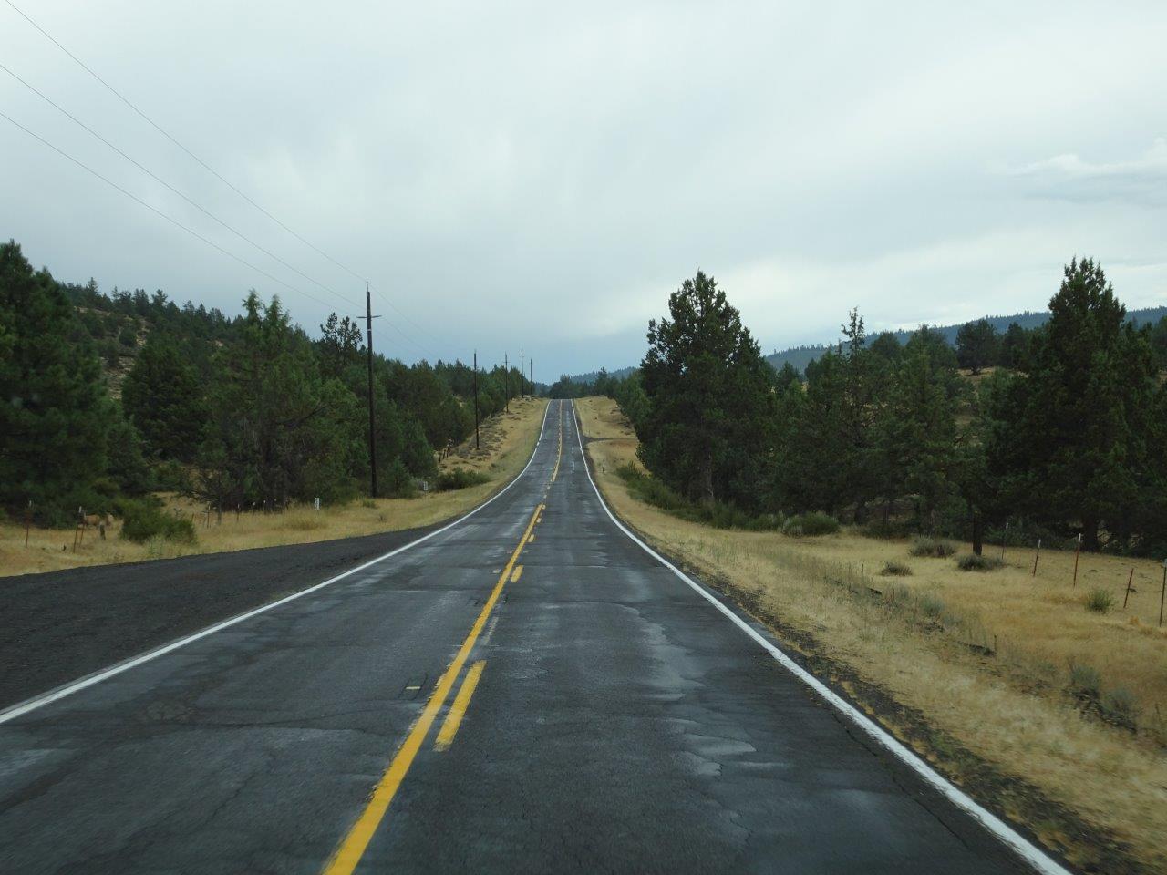
This is the road in front of the campground. 

I thought this was a chipmunk, but in looking it up, I discovered it was a golden-mantled ground squirrel.  Apparently, you can tell the different between a chipmunk and ground squirrel because the ground squirrel does not have stripes on its face.  The ones around here are just a little bit smaller than the chipmunks I am used to seeing in the east.  (Did you know that there are more than 20 species of chipmunks?) 

Some friends and I drove into the "nearby" town of Susanville on a very curvy road with a speed limit of 35 MPH.  And Reno, NV, is not that far away, surprisingly.  


More photos of the lake on a sunnier day.   This grassy area should be the beach, but when the lake level really went down a couple of years ago, grass grew on the beach, so there is no beach anymore. 


This is the other end of the bike trail, heading towards another campground.  I did not make it all the way because I got worried about falling and not having anyone to rescue me.  Maybe will try it again tomorrow.  

And a really big tree near my campsite.

Wednesday, August 9, 2017

8/6 Drive from Oregon to Eagle Lake, CA

It was a very long drive today--325 miles to be exact, which is a lot longer than I wanted to drive, but I had to get out of the Oregon heat and get to this place, which was supposed to be cooler.  Eagle Lake is in the far northeastern corner of California in the Lassen National Forest.  And actually, it is not too far from Reno!  

The nearest town is Susanville, which is about 20 miles southeast of here.  I came in from the north through Klamuth Falls.  Warning:  There are some really bad photos to follow, but since it was pouring rain for most of the drive, and I could not stop to take photos, I decided to include them anyway.  

This "fog" is not rain, however.  It is pure smoke!  I can tell because of the smell and the fact that it makes me cough when I open the window!  So northern California has also been having wildfires. 


I took this photo because I thought the bends and faults in the rock were interesting. 

OK, here come some of my bad photos.  It had started to rain, and the camera did not have time to focus, but this is a firefighter camp, one of several I passed.  This was the biggest, however, with maybe a dozen big tents and 60-80 vehicles.   


Hope the rain helps these guys out and clears the air a little. 

I had pulled over to get a snack and could not resist taking pictures of this sign. 

You can see the smoke they are warning about. 

Another camp about 30 miles down the road.  This one was smaller, but tucked farther back off the road, so hard to get a photo. 

You can see the mountains in the distance, so the stuff in the sky was probably rain clouds and not smoke.  It rained during most of the last 100 miles of my drive, which was good.  And other than fire trucks, there was almost no traffic. 


Finally, Eagle Lake in the distance.  I'll post more pictures tomorrow of the campground, which is in a ponderosa pine forest at 5,100' in elevation.  
 

Tuesday, August 8, 2017

8/5 The Cove Palisades State Park

This is one of the more unusual state park campgrounds I have stayed in because it is a reservoir in a deep canyon that is located in a high desert plain.  I posted a few photos of driving here on August 2, but mostly that was of the roadway, not the campground. 

There are two reservable campgrounds here--Deschutes and Crooked River.  Crooked River is in a flat area just inside the main road entrance.  Deschutes is four miles inside the park and located in the middle of a peninsula forming the center of an upside-down Y.  You can see the Y in the green area on the map below. 

The state park is very large, but you can see the two branches of the river go a lot farther and have more campgrounds along the way. 


 You enter the state park from about the middle of the Y and then drive down a steep and winding road into the canyon.  No guard rails to protect you from the dropoffs.

Arriving, you cross the bridge below from left to right and then climb up the middle of the upside-down Y. 


Lots of curves and no guard rails, of course. 


I have been here before and this is normally a pretty lake, but there is a lot of smoke in this area because of wildfires in Oregon, Washington, and even British Columbia. Everything looks hazy, but it is really smoke. 

This photo shows where the campground and one of the dayuse areas is.  

I took the next few photos the next day in the morning when the smoke had clearer.  One of the nice things about this part of the campground is that all sites are full hookups, meaning you get electricity, water, and sewer hookups.  Nice!   The back end of my motorhome, by the way, is almost hanging over a steep hill.  Made sure I set my parking brakes and put out one wheel chock.

Some more photos of the campground.  It is about halfway down the canyon, so there are cliffs in the distance, but unfortunately, it is also not near the reservoir.  There is a day use area across the roadway, but you would have a steep slide down a couple of hundred feet to the water, and there is no beach at all.  Best place to swim is three miles away by the marina.  Most people seemed to have boats and a bunch of those huge floats.  I also saw some kayaks and a lot of wave runners!  Since it was 99 degrees while I was there, even I would have been tempted. 


Now, why would I take photos of a recycling center??  Obviously, because they are so rare.  I carried all of my recyclable bottles from Ohio, through Indiana, then Illinois, through Missouri and Kansas, and even through Colorado because none of the state or Corp of Engineer parks had places to recycle!  It was not until I got to Utah that I was able to dump my two huge bags.  This was the best recycling center I have seen so far.