I am staying at Heaton Bay Campground, which is part of the White River National Forest. I had tried to get a campsite here when they first opened six months ago, but was unsuccessful. I was lucky to find a cancellation a couple of weeks ago so I could escape from the heat in Zion. This place is along I-70 and less than a two-hour drive from Denver, so it is a busy place on weekends and during the week for that matter during summer.
The reason temperatures have been in the low 70s instead of the 100s is that the elevation is over 9,000 feet. The campground is on Dillon Reservoir and surrounded by snow-capped mountains that are 14,000 feet high. Very beautiful, although the oxygen level could be a but higher! I have a very nice campsite:
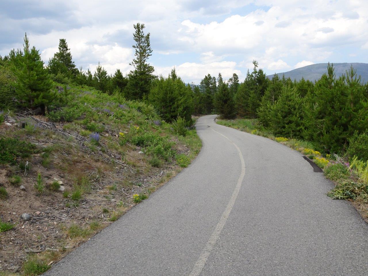
 There is a paved bike trail all the way around Dillon Reservoir so it is easy for me to take my electric bike and zip into either Frisco on the western end of the lake or Dillon across the dam on the eastern end. Today, I rode into Frisco, picked up some groceries, and then rode to the dam. It was a total of 11 miles, but even with an electric bike I really needed a rest when I got back. Whew! And I thought riding a bike at 7,000 feet at Grand Canyon was hard.
So here are some photos of the bike path:
I think this area was burned a long time ago. There are only small trees, but it will not take too long to lose these views as they grow.
Frisco is about three miles away. A lot of small stores and not quite as big as Dillon on the other side of the reservoir, but handy for picking up fast food and small things.
I know this is tilted, but it is the best I could do right now. One thing I did learn when camping a couple of days ago on the southern side of the reservoir, about in the middle near the top, is that the bike trail is really steep on that side of the lake.
These apartments in Frisco have great views over the lake and excellent access to the bike trail, as well.
Could not resist stopping for this wildflower covered hill.
There is a paved bike trail all the way around Dillon Reservoir so it is easy for me to take my electric bike and zip into either Frisco on the western end of the lake or Dillon across the dam on the eastern end. Today, I rode into Frisco, picked up some groceries, and then rode to the dam. It was a total of 11 miles, but even with an electric bike I really needed a rest when I got back. Whew! And I thought riding a bike at 7,000 feet at Grand Canyon was hard.
So here are some photos of the bike path:
I think this area was burned a long time ago. There are only small trees, but it will not take too long to lose these views as they grow.
Frisco is about three miles away. A lot of small stores and not quite as big as Dillon on the other side of the reservoir, but handy for picking up fast food and small things.
I know this is tilted, but it is the best I could do right now. One thing I did learn when camping a couple of days ago on the southern side of the reservoir, about in the middle near the top, is that the bike trail is really steep on that side of the lake.
These apartments in Frisco have great views over the lake and excellent access to the bike trail, as well.
Could not resist stopping for this wildflower covered hill.
This is at the dam looking across at the town of Dillon. There are more stores there, like a Lowes and an outlet shopping area.
The mountains near Dillon are part of the Arapaho Basin Ski area. Breckenridge is only about 10 miles away, but I am going to be driving past there on my way to my next camping area on Friday, so I will be lazy and not head there until then.
I left Zion National Park because of the 106 degree heat and headed north and west through Utah to the high country of Colorado. This drive actually took two full days, but I thought I would combine them because of the differences in scenery. (In reality, Utah does have high mountain areas, but those are mostly in the northern part of the state.)
Utah has more color and dryer country. Most of my drive, by the way, was at around 4,500 feet in elevation. Very pretty drive with rock formation and "moon-scapes."
What amazing variations in color!
On the second day, I was clearly at a higher elevation and following the Colorado River. Lots of water in the river, so I hope it helps to fill Lake Powell and Lake Mead!
Most of these river photos were taken near Vail, Colorado. They did a very good job of fitting I-70 in between the canyon walls. This area is about 7,000 feet in elevation, so much cooler than the lower areas in Utah.
The road climbed up to 9,000+ feet in elevation and you can see more snowy peaks. This is my exit for Dillon, Colorado, which is part of the Arapajo Basin, a very popular skiing area.
The only campsite I could get in this area was at Prospector, which is managed by the Bureau of Land Management. Not even any electricity, but the high temps were predicted to be in the low 70s, which is the only thing I really cared about. This photo was taken on Sunday after all the weekenders had left, so I had the place to myself.
View of mountains from my campsite.
And of course, Colorado has lupines!
It was horribly hot at Zion this year--highs of 106 one day and 108 the next. The other times I have been here have been in April or September, so it was cooler. It is a pretty place to camp and inexpensive, but I think I will avoid this place during the summer from now on. Luckily, I had a slightly shaded spot this time.
Last time I was here, the Virgin RIver was roiling and full of fast-flowing water. This time, it was moving fast, but clear and not so full of snow-melt. Kids were wading and floating on tubes.
One of the things I like about Zion is the shuttle system. They run every few minutes and take you back and forth to town and up the canyon. Unfortunately, as you can tell by the open ventilation panels, they were NOT air conditioned as the buses at Grand Canyon were.
Rode the bus all the way to the end and then headed up the riverwalk trail. The canyon gets very narrow here, but the trail is paved and mostly handicap accessible. The best part is that we were in the shade all of the time and it was cooler in the narrow canyon than in the rest of the national park.
The river is clear and shallow here, so lots of people were taking advantage of the opportunity to cool off.
Also, if you are daring enough and have a walking stick or two, you can walk up the canyon another mile or two. Most of the time, however, you are walking in the water on very slippery rocks, so most people go just a hundred feet or so.
Looks like an oasis in the desert, doesn't it?
One last picture of a rock squirrel family sunning them selves before beginning their day. Rock squirrels are desert dwellers and live in burrows, but the ones at Zion National Park, spend their days begging from tourists. They are very aggressive and will climb onto your lap if they think you have something to eat--I know this because they did it to me once when I was sitting on a rock ledge. They are supposed to be eating flowers, buds, and other desert plants! I agree that they are cute, however.
Tomorrow, I head for the mountains of Colorado to escape the heat!
If you could throw a rock a very long distance, Zion National Park is only about 150 miles from the south rim of the Grand Canyon. However, since there is no bridge over the canyon and a lot of mountains and mesas get in the way, you have to drive the long way. The most scenic route is going through Page, AZ, and then entering the park from the east, through the Zion - Mt. Carmel Tunnel. It is not the tunnel itself which makes this scenic, although it is a neat drive-thru, it is the drive through the canyon to get to the tunnel which makes this the best way to go.
Leaving Grand Canyon, you head south to U.S. 89 and then north to Page. The land starts out fairly flat along U.S. 89, but as you get closer to Page, the road climbs up above the valley and cuts through the rock to the top of the mesa.
Then you drive down the other side of the mesa and can see page and Lake Powell in the distance.
If you have a couple of extra days, Lake Powell is a great place to spend some time. I highly recommend the Wahweap Campground and the hotel on the lake. Both are on the north shore. This photo shows driving over the Glen Canyon Dam that forms the lake. If you don't have extra time, at least stop at the visitor center at the far end of the dam, on the right. It has some great views of the dam and lake and some interpretive exhibits.
The lake is very low these days, which means some boating channels have been cut off. There is more water than last year, but they also must release water into Lake Mead, which has also been suffering from overuse of water and drought. And apparently, the rocks under the lake tend to leak, so there is some consideration that Lake Powell may cease to exist in the next couple of decades.
A lot of varied terrain on the way to Zion National Park.
About ten miles from the Zion-Mt. Carmel tunnel, the road dips into a narrow tunnel filled with the petrified remains of old beaches from an extinct ocean. You can see the patterns of the layers of sand in the rock. This is called Checkerboard Mountain because of the vertical cracks intersecting with the horizontal sand layers.
Lots of pull-offs along the route, plus interesting places to hike.
We have reached the tunnel. You can tell because of the line-up. RVs taller than 11' must pay a $15 fee to have opposing traffic stopped so they go through the tunnel in the middle. It is surprisingly hard to drive on the double yellow lines!
Through the tunnel!