Signed up for the 11:00 a.m. glass-bottom boat tour today. They picked us up at the campground, which was nice. Pulling out of the port of Tobermory, we were lucky to see the Chi-Cheemaun loading vehicles. Good photos of the open bow!
This is the Big Tub lighthouse. I think we went swimming here in about 1982 when we were last here in Tobermory.
And the first ship we saw was the 122 foot City of Grand Rapids that caught fire in 1907. After the crew was rescued, it was towed out of the harbor but ended up being blown back into Big Tub harbor and burning to the water line.
The viewing was actually better from the decks because you could see more of the hull at once.
In the distance is the
119 foot Sweepstakes that sank in 1885. Most of it was salvaged before it sank, so there is not much left.
Most of the boat tour was around several of the islands in the area. This little island is called White Rock, and a lot of birds nest here.
Very narrow passage here, but because the water is so deep, it was not dangerous.
Looking out into the main part of Lake Huron at Michigan somewhere in the distance.
These are the old lighthouse keeper facilities on Flower Pot Island. The tour boat circled this, but I think I will take a shuttle back tomorrow and do some walking.
Modern lighthouse at Flower Pot Island.
Rocky beach at Flower Pot island. Lots of people sitting in the sun, but did not see anyone actually swimming in this icy cold water.
Back in Tobermory.
Tobermory is a small town on the tip of the Bruce Peninsula that juts out into Lake Huron and divides Georgian Bay from the rest of the northern lake. Here is a map of the area.
I'm staying a few days in a campground within biking distance of town. Good thing it is within biking distance because as pleasant looking as this campsite is, it was VERY hard to make the turn at the end of the roadway and back in without damaging my paint. As it was, I needed help from two people to help direct me, and the gel coat got scratched in several places. I am hoping the scratches are not permanent.
Anybody ever take the ChiCheemaun ferry? I just missed its leaving port and so was not able to get the photo of the front end closing, but if you look closely in this photo, you can see where the front end pulls up for loading.
It is heading to South Baymouth on Manitoulin Island on the north shore of Lake Huron.
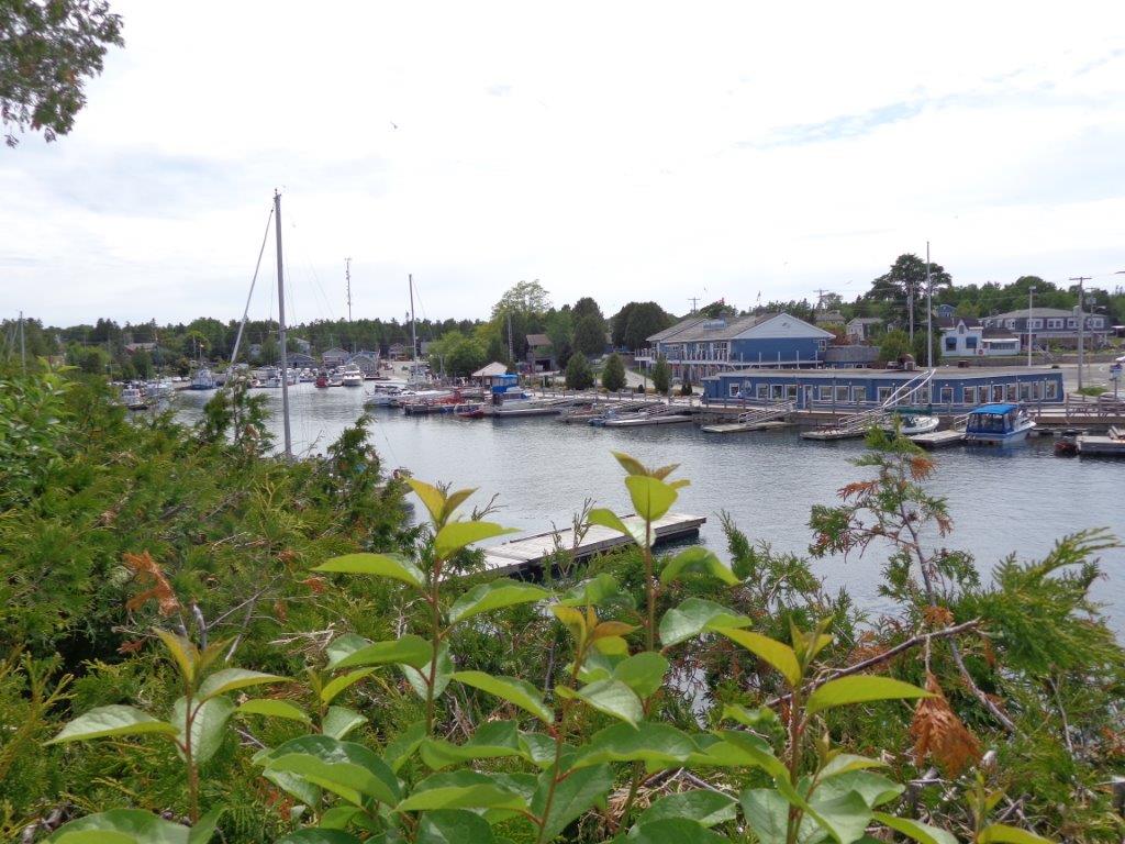
Some views of the harbor from the opposite side.
I'm staying here in Owen Sound for a few days because it is where my great-grandparents met and married, and I wanted to do some additional research on them. So, on this day, I headed out for the local Grey county museum and heritage center. I was expected the usual small town museum in an older building, but what I found was this huge, modern facility!
There was an animatronics dinosaur exhibit, so of course, there were school groups and a lot of noise. This guy met you at the door.
Part of the exhibits.
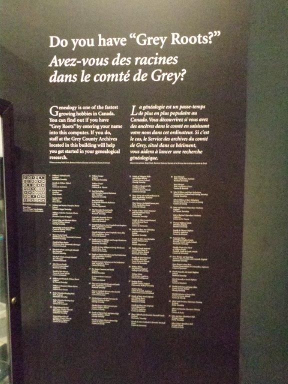
No, my family was not listed here, but it was interesting to read.
I spent a good two hours in the genealogy center, getting help from the staff. No charge, other than the museum entrance fee and copying.
Then, I headed east to the small town of Meaford where my paternal great-grandparents were married. You can see Georgian Bay of Lake Huron in the distance. I am driving downhill here because the road goes over the Niagara Escarpment, which makes the entire Bruce Peninsula.
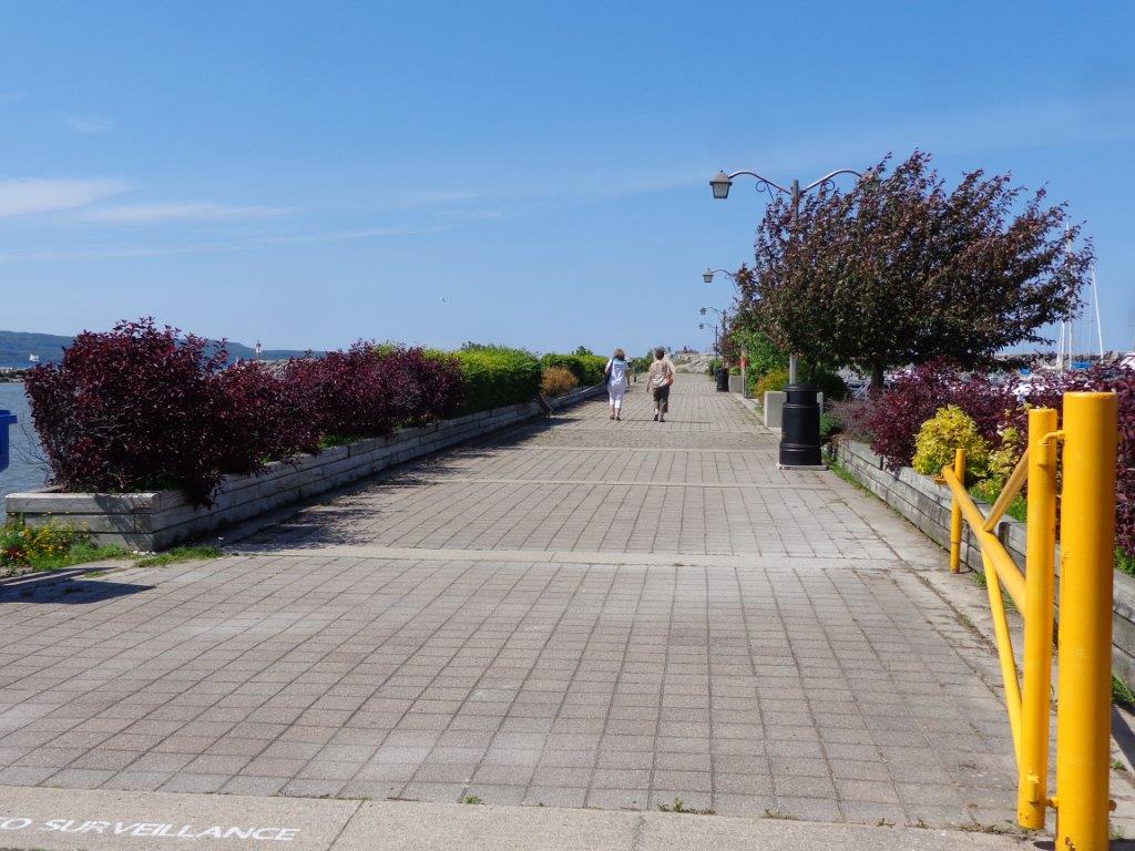
Pretty harbor area and walk onto the breakwall.
Water is exceptionally clear in this part of Lake Huron. In a few days, I will be headed to Tobermory, which has glass-bottom boat tours of shipwrecks.
I took the long way around Michigan's "Thumb" today to get to my camping spot for tonight near Port Huron, MI. My cousins and I grew up playing around what would someday become Port Crescent State Park. The day use area is now on what we used to call the sand dunes. The lake here was always sandy and great for water skiing.
Water has been down for the past several years, so grass has grown in on the beach. Water has been up somewhat, though not to historical levels, for the past couple of years, so not much beach showing. This is from Port Crescent SP day use area, looking west.
A small path down to the beach.
Part of the remnants of the old sand docks. Wonder how much if left in the water? In the late 1800s, it extended several hundred feet to allow big ships to come in to get sand. Port Crescent was indeed a port and a serious town in the late 1880s until the entire area burned after it was logged over. Remaining buildings were dismantled and taken to other small towns nearby.
Even though the beach was narrow, the water is sparking clean! That is nice to know because there have been problems with farm fertilizer run-off in the past decade.
Looking east toward the campground and the point. I was too lazy to walk to the river, which I should have done to get photos there.
Driving on toward Port Austin. Look familiar, friends and family?
On the way, I could not resist stopping at Jenks Roadside park. I had the whole place to myself! It was clean and very well taken care of.
Looking west along the beach.
More sparking clean water.
Looking east toward the point. Very happy to see a clean beach.
I filled a container with water from the well, but it was so full of rust that it looked cloudy and settled down on the bottom of my container, so I ended up dumping it down my toilet.
Coming into Port Austin.
One of the more memorable cultural spots in town.
My last stop today was along the eastern side of the Thumb, at a small roadside park. I had never known about this rock.