Tuesday, August 30, 2022

8/25 Kodachrome State Park, UT

I had stayed here overnight a couple of years ago, but I was teaching at the time and needed cell service so I could get internet access on my mobile hotspots, so could not stay longer.  This trip, I had more time, so I spent four nights here.  It was not easy to manage without internet, but I solved the problem partially by going out a couple of times to a nearby town and catching up with email and other items I needed to do online.  

Other than the incredible scenery, the one positive of this campground is that it has quite a few full-hookup sites, so at least I had power, water, sewer, and a good TV signal!  The 8,000' altitude also meant it was cool here, with daily or even twice-daily showers due to the summer monsoons.  This kept the dust down and turned what was usually desert into a lush green.  There was also a lot of little streams and even water in what was usually dry washes.  

This state park is also only 24 miles from Bryce Canyon National Park, so it was a quick drive. 


This is the visitor center for the campground and the only place where you can get a bit of internet, however, I chose to use my own mobile hotspots because they are more secure, so I headed to town.  The main reason for the lack of cell service is the tall bluffs that surround the campground.  


I don't know the history of this, but way out here in this state park is a laundromat!   


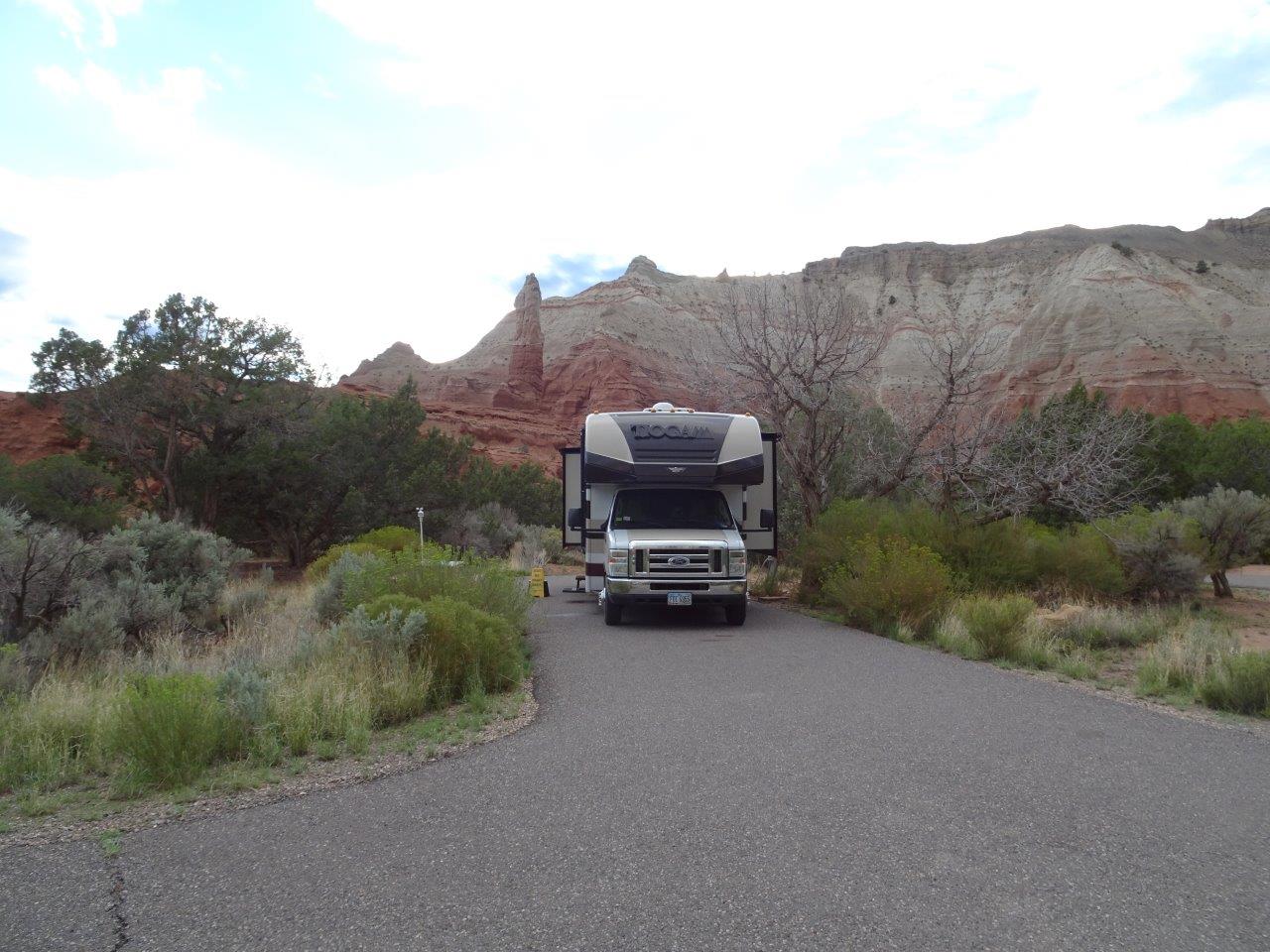
  This was my campsite, nicely tucked into a private spot.


Beautiful scenery in this campground.  Unfortunately, I was not able to take any of the short hikes because it kept raining whenever I would get ready to head out!   


The next few photos show the results of all this rain in what is usually very dry desert.   This are on the way into the state park is currently range land, although I saw very few cattle.   However, notice that there is a lot of green in these next photos--mostly a lot of new grass. Normally, it would be brown and dry.


This shows where the rain caused the muddy water to flow over the roadway.  It is dry in this photo, and you can tell that the state park has plowed some of the dirt that remained.


However, the next day, it was wet again with more mud having flowed over the road. 

And the next few photos show the water flowing in the nearby wash.  Normally, this will not have water in it for months or even years, but there is an amazing amount now. 

There were a lot of little creeks in the campground and park that had had water in them and that flowed into this river.


As I was leaving, I noticed this in the distance, towards Bryce Canyon.  At first, it looked like a rain cloud, but as I got closer, it looked like a fire, but I could find nothing about it online.


Onwards to Las Vagas tomorrow.  I will stay only one night there and then head to Southern California. 

8/22 Bryce Canyon with Friends

Last trip here, I stayed in the no-hookup national park campground, but it was very hard to get a site big enough and level enough for my rig.  So this trip, I splurged and got reservations for four nights at the nearby Ruby's RV park.  The shuttle is very close, and I was able to enjoy full hookups and a very clean laundromat to catch up on the three loads of laundry I have been carting around.  

First, thanks to my friend, Beth, who is another full-timer, for picking me up and bringing along her friend, Ginger.  I really don't mind sightseeing alone, but it is a lot more fun to do it with friends because you get more perceptions.  Also, I did not realize before that there are places on the main road through Bryce Canyon that you can see only if you have a car--some places are off-limit to RVs because of the lack of parking.   

Be prepared for a long post because I took a lot of photos!!!  They are mostly in order from the entrance to the far end of the road.  And because it was a beautiful sunny day, the photos turned out very nicely. 

For example, look at the brilliant blue of the sky, the yellow and orange of the rock, and the green of the trees!!  (Being at about 8,000' also makes the sky bluer.)

I would have loved to hike down into the numerous valleys at Bryce, assuming of course, I was about 30 years younger and in a lot better shape!!


The elevation at the start of the drive is about 7,500', but the farther you go towards the end of the road, the higher you get, and the less oxygen you have to breathe.  I don't know how the young hikers manage.

What a view into the distance!!! 


Very nice arch. 


This is one of the popular spots for hiking.  You can go down just a few feet or all the way to the bottom here, but we just watched from the top and wondered how these people are going to get back up. 

I know these photos must be looking all the same, but it really all looks different when you are there. 

Cute little guy.  Do you know how to tell the difference between a ground squirrel and a chipmunk?  This little guy is a ground squirrel because he has stripes on his back, but not on his face.  Easy!


I used my telephoto lens to take this photo.  Later, I realized it was the small town of Tropic, about ten miles away.

Such brilliant color!


Another trail we just watched and did not hike ourselves.

The trail goes in and around a lot of these spires or "hoodoos" as they are called.


Thought this was fireweed, but the flowers are too small.


A bunch pf people on the hiking trail. 

OK, is this a ground squirrel or a chipmunk??  Which one has stripes on its face??


You can't see it easily, but the hiking trail goes down into this chasm.

Makes me dizzy just looking down! 


Wednesday, August 24, 2022

8/21 Drive Through Red Canyon to Bryce Canyon National Park

It was such a pretty drive to Bryce Canyon that I decided to give it it's own space on my blog.  One of the first impressive views was looking down into the valley from the high Kaibab Plateau.  Leaving the North Rim, you travel about 50 miles on Route 67, then turn west on 89A, which is the road that comes from Lake Mead and goes west toward the town of Kanab and a lot of national parks in Utah.  

The LeFevre Overlook is right on the edge of the plateau, as shown below.  On the plateau, the altitude is about 7,000 to 8,000', and it is full of trees. 


In the far distance are Zion National Park, Bryce Canyon National Park, Capitol Reef National Park, and a lot of high-interest places to visitors of all kinds.

And down we go!!!!

 
Past the towns of Kanab and Mt. Carmel Junction, you will eventually hit Route 12.  (If you have missed stocking up with groceries in Kanab as I did, you will need to take a short detout to the small town of Panguitch, as I did.  There are only a couple of camping stores in Bryce and in Kodachrome State Park, where i am headed after Bryce!!)  
 
After turning back east on Route 12, you drive a short but very pretty route through Red Canyon, which is what the next few photos is about.


This is all just a hint of what Bryce Canyon will look like, but pretty in itself!!