Thursday, October 12, 2017

10/12 A Tale of Napa Fires

I have family members who live in Napa, California, so I try to stop by there for a visit as often as I can while not making a nuisance of myself.  I arrived on Saturday afternoon (October 7) and set up camp in the county fairgrounds, aka EXPO.  It is really an extremely nice campground within a few blocks of downtown with the city bike trails handy for getting around.  It has nice, long, paved pull-through sites and a few back-in sites with full hookups and nice grass between sites.  

I was only planning to be there for two nights, so they assigned me a back-in site close to the Silverado Trail, which is one of the busier roads in Napa.  My family members live about half a mile east of the campground, so it is very handy.  

Sunday, we went to the pumpkin patch to pick out pumpkins, as I wrote about in my last post.  I had seen on TV that there was a junkyard fire about five miles south of town.  The newscasters said the smoke could be seen from San Francisco, which is a very long way away, but that evening, I went to bed thinking that is all that was happening in town.  However, starting at about 10 p.m. until at least 3:00 a.m., I heard constant sirens going past on Silverado.  And I really mean constant, but I thought it was the junkyard fire.  There was also a heavy smoke odor inside the RV even with all my windows and vents closed.  The strong wind was also rock and rolling my vehicle.

I had a very early doctor appointment and had to wake up at 5:30 a.m. at which point I realized from the news that more was going on.  Silverado Trail is the main north-south road that goes to the Silverado Country Club and the surrounding subdivisions about three miles away from me.  That is the main area you see on the news when they show Napa homes and buildings destroyed.  I cancelled my doctor's appointment because the smoke was getting heavier and headed out to the ophthalmologist to get my new glasses.  Luckily, they were opening, and I picked them up, then headed out of town on my way to Oakdale, CA and Yosemite, still not really knowing the extent of these fires. 

This is what it looked like as I headed out of town early Monday morning:

This photo was taken from the west side of town, looking east to what became the Atlas fire.

The sun really looked weird because of all the smoke.  Also, my camera lightened this image a little, but in reality the sky was much more orange.

I headed east of CA 12 towards I-80 in Fairfield and took this quick picture looking north from my window, which is back toward Napa.  It is hard to tell from this photo, but this area is maybe 10 miles south of Napa, which shows how big the Atlas fire was and where it was spreading.

(I did not take the next few photos.)  By Monday at about 7:00 p.m. the Atlas fire was headed east and was n a ridge about half a mile from my relative's home.  They had spent the day packing up and getting ready to evacuate, so that is exactly what they did this evening--heading to another relative's home away from Napa.  This was a cell phone photo and NOT taken using a telephoto lens.  

The scary part about all of this is that nobody was yet fighting the fires.  The fire crews were focusing entirely on evacuating people and not much outside help had yet arrived.  If your house caught on fire, you were on your own!

This next photo was taken the next morning, Tuesday, by a friend of the family who had returned to check things out.  (Note: the construction vehicles have nothing to do with a fire, but were there for a new subdivision.)  Overall, things looked better and no flames could be seen.  That is because the winds had changed and the fire was continuing to head south to Fairfield. 

My relatives returned on Tuesday, but everyone stayed inside because of the smoke.  Things were looking good because of the changes in the wind.  Unfortunately, things took a turn for the worse on Tuesday afternoon.  This photo was taken facing east, so winds were now headed north instead of south. 

These next two photos were taken later Tuesday afternoon. Part of what is burning here is Skyline WIlderness Park, about 3/4 of a mile away.

It is amazing how fast things change depending on the whim of the wind.  For while things look better, and then they get worse.

Notice that wind has calmed down because smoke is going up more than across.  

This was taken late Tuesday.  However, this flareup is at least 200' wide, so still a scary fire.   
Napa issued a warning to get ready to evacuate for anyone east of Silverado Road on Wednesday, so my family left again.  As of Thursday morning, the mayor gave a positive report that the wind seemed to be staying calm and that the fire had not spread much overnight.  There are now about 600 firefighters from all over the country working on just this fire.  Many more on the other fires.  We are hoping things get better soon and all these fires are put out. 

While all of this has been happening, I have been in Yosemite.  I will post more photos later on that, but this picture taken on Tuesday afternoon as I drove into the park shows that there is smoke from other fires even in this area, as you can see from Half-Dome!  


Sunday, October 8, 2017

10/8 Pumpkin Patch, California Style!

Went with my grandkids to the pumpkin patch today.  Course, I am not used to going to pick out pumpkins in anything but cold, rainy weather, but I guess I can adapt to sunshine and 86 degrees.  

The fun part of the pumpkin patch for kids is the huge haybale climbing structure.  You can even go inside.  Not sure what was in there because I bypassed that. 
 
 When I was a kid, all pumpkins were orange, smooth, and round. 

Ah, some "normal" pumpkins! 

They give you a cart to pull or a wheelbarrow to haul your pumpkins.  We ended up with a wheelbarrow and filled it pretty full. 

These are "swan" pumpkins.  If you use a little bit of imagination, you can see long swan necks and beaks. 

 These next two photos show the piles of smaller, really weird gourds and pumpkins.


I promised to get a pie pumpkin and make a pie for Thanksgiving from a real pumpkin instead of using canned pumpkin.  Too early, however, and none of these qualify. 

10/3 Bandon, OR

Bandon is one of my favorite towns because of the bakery and shops, and also because of the carved wood art pieces in the harbor area.  It is only a couple of miles from the Bullards Beach State Park, and I probably could have ridden my bike there, but I drove instead.


I was very disappointed when I first arrived at the state park to find out that the bakery was closed, however, it opened on the day I had to leave, so I made sure to stop by on my way out.  This is a real bakery that makes their own bread and pastries--YUM!  I stocked up and put some things in my freezer for a rainy day.  (On a rainy day, a cranberry bar or an almond bear claw tastes wonderful!)

Some other nice shops that I have been to before, so I did some shopping for some stocking stuffers for Christmas. 

This shoppe has a lot of different flavored gel candies.  The best ones are wine flavors!
 

Sprinkled throughout the harbor area are these carved wood characters. 


There is a nice fishing pier and a boat ramp right in town. 


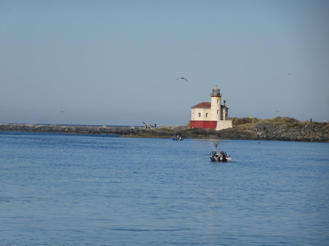
And this is the same lighthouse I took photos of the other day.  I walked on this pier that day also. 


Some unusual benches also.  

 And several seafood restaurants.

Nice to see so many brown gulls.  These brown gulls are really babies or juveniles and don't turn white until they are fully mature at the age of five years.  Often, you will see a young gull with a while parent nearby, keeping an eye on them. 


This is the foghorn I could hear from the campground.  

This is the beach near the entrance to the harbor, about half a mile from the little town area.


Tuesday, October 3, 2017

10/1 Bullards Beach State Park, Bandon, OR

I've been here a few days, but it has been cold and drizzly, so this was the first day I got my bike out and went for a ride.  One of the negatives of this campground is that you really need to drive to the beach because it is a couple of miles away.  A positive, however, is that it is a really nice, broad beach, very private, and has a great lighthouse and old pier to walk on.  

It's funny, but at some campgrounds, everyone sticks to themselves, and I barely talk to anyone.  Here, I had visitors and made friends with several other campers, as well as the couple camping next to me.  Even got invited to a cookout one night, which was fun, although really cold.  Temps in the daytime are usually in very low 60s, but it has dropped down at night to as low as 46.  Brrrrr!  And the dampness makes it feel even colder.  

The campsites are pretty nicely sized and not too close to one another.  Note plastic bag on bike seat.  Even though it was covered, it somehow managed to get wet on the edges.  


This is the road to the lighthouse and beach.  

This is the Coquille River outlet.  On the other side is the town of Bandon and the pier with the fog horn signal.  

 Like a lot of Oregon and Washington beaches, this one is full of old logs.  
This sign explains the old lighthouse. 

 This is the old pier, which is right next to the lighthouse.  Of course I had to walk out on it.  

 It is definitely an OLD pier! 

Looking north along the beautiful beach.  Much too cold for swimming or even wading, however.  

Nice big waves today. 


I used my telephoto lens to look across the river at the foghorn.  It has been blowing a lot lately since there is fog almost every day until at least noon.  

And this is Bandon.  

 
 There were even some big logs on the pier.  They must have blown up in a big storm.

Not a huge lighthouse, but you can go inside and climb to the top most days when it is staffed by volunteers.  It was closed because I was here fairly late in the day. 

 I am leaving Bullards Beach on Tuesday morning, but I am going into Bandon and will try to take some photos of that very pleasant little town.  Also, hope the bakery is open so I can get some goodies.