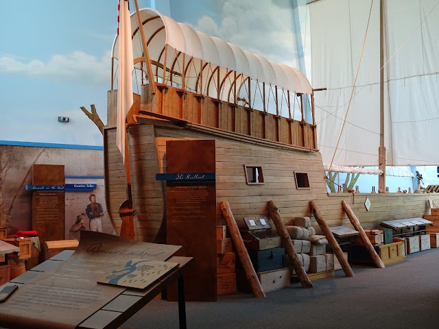
I have been to a lot of Lewis and Clark museums across the country, mostly in the Northwest, but this was the first in this area. This area where the Misouri River joins the Mississippi is where the explorers spent the winter and bought supplies before they set off on their long journey.
A commemorative plaque outside of the building. No fee to enter the building, by the way.


It was a cutaway, so that you could see the outside of the boat on one side and the inside on the other. It seems awfully tall and narrow, but the real ship was built in this area by people who made their livelihoods on the river, so it was apparently a good design.
Besides the keel boat, the expedition also had several dugout canoes follow along, carrying the stuff they could not fit in the main boat.
This side of the ship shows how they stored food and supplies in compartments in the hull. Note that there were no cabins for the crew. They slept on deck, possibly shielded by canvas tents.
Lewis and Clark, however, had a couple of cozy bunks in the cabin!
I thought this list of scientific instruments was interesting.
Just more displays....
Down the road about half a mile is this tower. There was a $6 fee for the guided tour you had to take to be escorted to the highest part of the towee.
This is a contour map showing the confluence, or combining, of the two big rivers.
The Mississippi is in the distance. All the water in the foreground is covering fields that are normally planted by now, but this area has had 16" of rain in the past two weeks, so things are flooded.
Note two things in this photo: the road on the left that has water over it and the bike trail on the levee that is 30 miles long.
It is only another few miles down the river to this sign announcing the museum and the COE locks and dam.
Very big dam!
The museum is in the modern visitor center. They offer tours all day long, and I got there just in time for one of them! No charge for museum entrance or tours, by the way.
The tour takes you to the top of the dam and lock structure. Then we walked along one side about halfway over, crossed over to the other side, and returned to the down elevator at the end of the tour.

This is the secondary lock. Mostly they use a larger one on the other side of the spillway on the right.
Good picture of the lock gate. I am taking these photos from the top of the dam structure.
Note the huge mechanism for closing the lock gate.
The control tower is on the left and the two walkways can be seen in the center and right. The crane is used to haul materials and equipment across the dam.
Found several Great Blue Herons fishing along the dam.
Tour took an hour-and-a-half, so I was pretty much reader to get off my feet and back to driving at the end.


No comments:
Post a Comment