However, for the past couple of years, the lake has been little more than a puddle because of the drought. But, now with El Nino, in less than two months, the lake has gone from 5% of capacity to 20% of capacity. And even though there has not been any rain for a few days, the lake is still rising because the water is still draining off the surrounding countryside into rivers and into the lake.
Here are two photos of the water intake tower from 2013. In the first picture, it is way in the distance on the right. Note how little water is in the lake.

Here is a similar distance view photo I took today. Compare this view to the above. It's beginning to look like a real lake.

This shows how you could walk right up to the tower in 2013. Notice that the base is entirely out of the water.

And these two photos I took today, shows that the entire base of the tower is now covered with water and you can no longer walk right up to it.


The next few photos show the ramps on this side of the lake. First is a Google map view, with the three boat ramps numbered. Google is slightly out of date, but you can see that the biggest ramp, #1, is completely out of the water. You can see that they added a gravel road down to the water at one point, but even that is out of the water. Ramp #2 is also out of the water, and the only ramp usable is Ramp #3.

Here are some photos of these ramps. This first one is Ramp #1 in 2013.

And here is Ramp #1 today:

This isn't the best photo, but this is Ramp #3 in 2013. Ramp #2 is on the right, but out of sight.

And this is Ramp #3 today. Ramp #3 is that road to the left with water now covering a lot of the rocks shown in the previous photo. They have closed that ramp because it is not in good condition and is gravel.
Ramp #2 in this view is way over to the right, near the porta-potties.

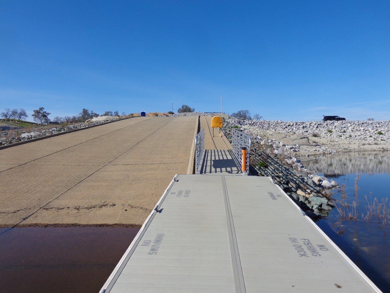
Ramp #2 is the one that is open and usable today. The rangers in the white truck had just winched the little dock up so it would not be underwater for the weekend. They told me the water had been rising 6" per day this past week. The big cable holds it tightly as it is guided by the curb on the right. The ramp is a lot steeper than it looks, by the way.

Nice side view of the moveable dock. They fasten a heavy rope onto the truck and just pull it up several feet.

Saw this lone white pelican as I headed back home after my bike ride. The lump on his or her beak shows that the bird is breeding age.

No comments:
Post a Comment