
This is looking back down the trail to the valley. You can barely see the campground in the distance.

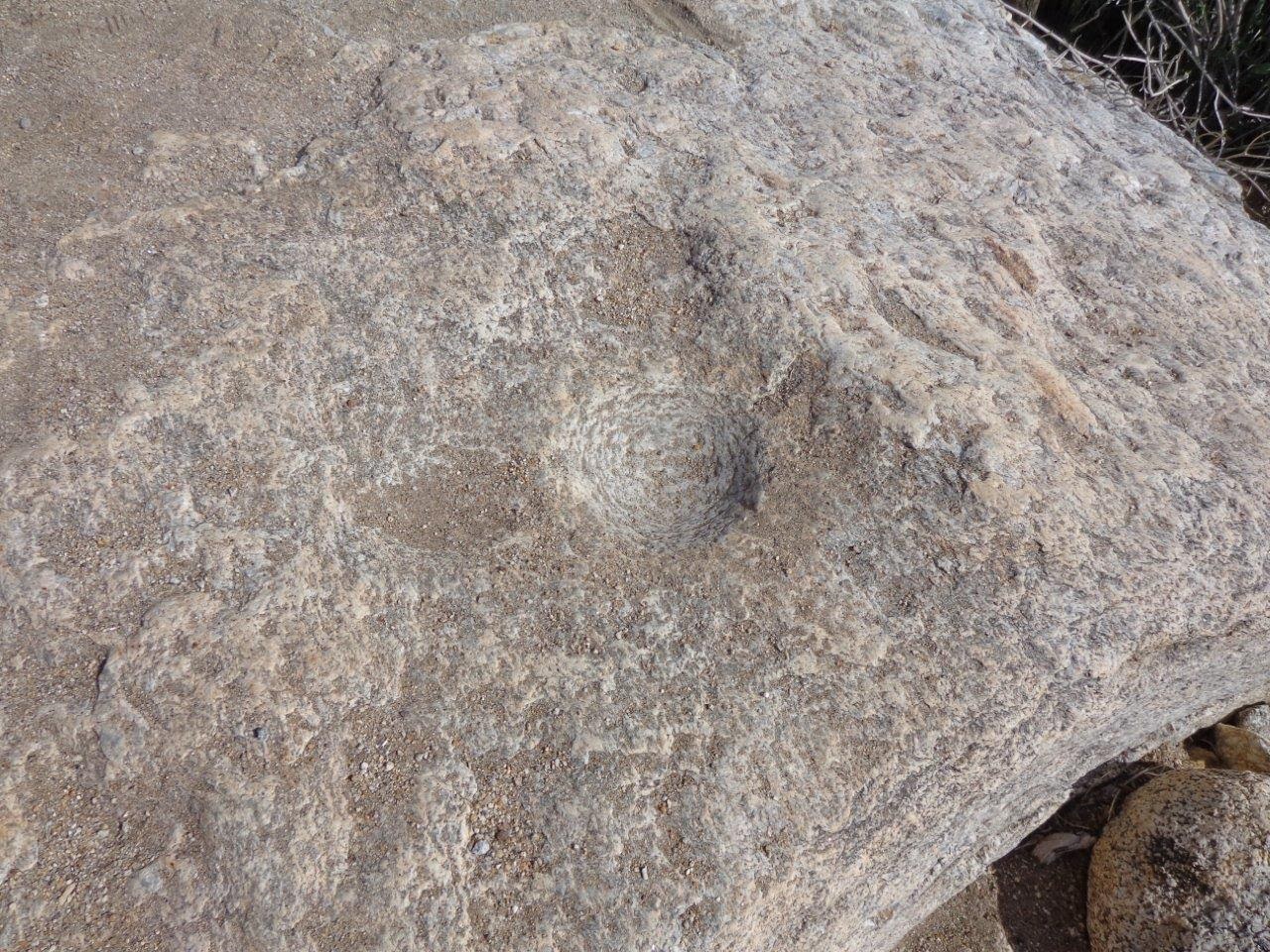
The native American's also used this area, and this is one of the holes they used to grind seeds.
Believe it or not, the trail goes just to the right of this creosote bush. Luckily the rocks seemed pretty stable. I had worn my new shoes which have good rubber soles and did not slip too much.

Can you find the trail here?

About halfway up, you first see the little creek coming out of the spring. Amazing to see water in such a dry desert.

Here is the first view of the oasis at the end of the canyon. These are native California palms, with thicker trunks and getting up to 60' tall.

This is looking back down the canyon where I walked.

Apparently someone has put down some steps. Makes it a lot easier, but would be even easier if they were more even.

Getting closer to the oasis.

And the trail really does go between those two big rocks. Have to really scramble to get through this rock pile. I went very slowly so as not to fall or turn an ankle.

And the red marker on the bush tells you the trail goes to the left, over the rocks. Would not know that were it not for the marker. Saw a couple of dads carrying small children over these.

Mature palm trees at the oasis.

You can see the waterfall between the big boulders on the right. This is what provides the water for the oasis.

It is dark and damp inside the trees. Hard to walk but the trail ends here. I suppose if you are very athletic, you can go farther.

These trees were so tall it was hard to get them all in the photo. Very impressive.

I chatted with several older couples along the trail. One couple had been here many times and recommended the "alternate" trail on the last half of the downward hike because it had fewer rocks to climb. They lied.

And more rocks to walk through. I was really tired by this point and my knee muscles kept going into spasms. I kept my eyes on the trail because I did NOT want to fall.

Yup, trail goes right over these rocks. There were dozens and dozens of places where I had to get down and practically crawl over these. About 2/3 of the way down, I slid and ended up sitting on my read in a bush which had a cactus in the middle of it! One of the couples I had met earlier, but NOT the one who had told me this trail was easier, found me sitting in the bush. The man helped pull me up and his wife kindly helped remove the spines stuck in the rear of my shorts. They were Australian, and she suggested I take off my "knickers" when I got home and use tape to get the rest out.

We did find a large flock of quail, and I managed to sneak a picture in before they scurried away. I later looked them up and discovered they are probably California uail, not Gambel's quail. They have very close ranges, but they do not overlap. This area is right on the edge.

So, after five hours of walking and rock climbing, I made it back to my RV. I took off my clothing before I sat down, used some duct tape to remove the last of the spines, and took a shower. It felt wonderful. Even though the hike was a LOT more strenuous than I had expected, I was really glad I had seen this very unusual place. Next time, I am going to take a flashlight, however, just in case I got injured. The sun sets fast this time of year, especially with the mountains, and although there were other people on these trails, a flashlight would have helped me get out or let someone find me more easily.
No comments:
Post a Comment