I've spent the last two weeks at this campground along the John Day River where it empties into the Columbia River. I cannot directly see the Columbia River unless I walk to the entrance, but this is a scenic place I have been to several times before. I enjoy the fact that it is out of the way and is very quiet this time of year--its been filled from 20% to 50% the entire time I have been here, so not a lot of people, but I like the smallness of the campsite and the views.
Tomorrow I head to a more central city in the Willamette Valley, and have appointments to get my water tank fixed or replaced. I also am pretty sure I need brakes and have not been able to get anyone near here to look at them, let along fix them, but I have an appointment next week to get them looked at, so it will be a very busy week.
Driving west on I-84, it is pretty hard to miss Mount Hood, a good 50 miles in the distance.

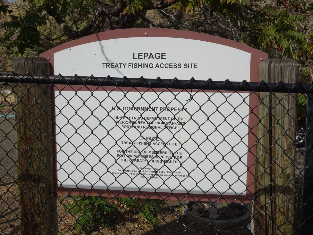
LePage Park can be easily found because of the bridge over the John Day River. John Day, after whom two cities, river, fossil beds, and a dam were named, was a fur trader in 1810. The area closest to the bridge is a day-use area that is also used by local native Americans as a fishing staging area.
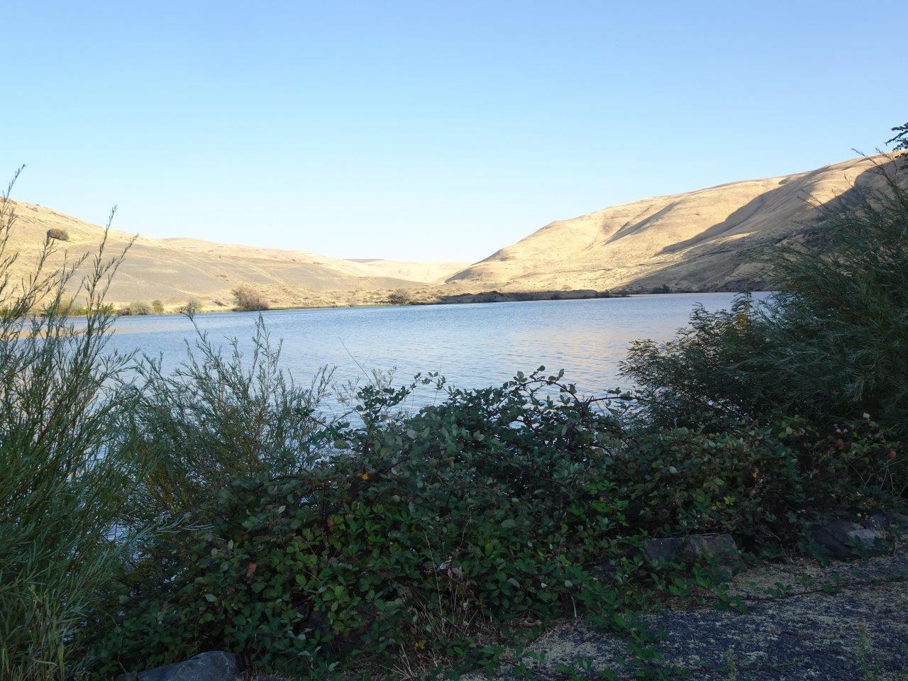
The John Day River empties into the Columbia River just east of the John Day Dam. When the dam was completed by the U.S. Corps of Engineers and closed, I was told the widened river here filled within hours, making a nice lake for boaters when winds were too strong for boating or fishing on the Columbia.
Because this campground was built and is managed by the U.S. Corps of Engineers, there is a 50% discount in cost by any seniors having a federal National Park Pass. The pass costs $20 annually or $80 for the lifetime of any citizen of the U.S. who is at least 62 years old. Not only do we seniors get the discount on camping, but we also get free admission at any national park, which is a real bargain since places like Yellowstone have raised their entrance prices over the last few years.
In the next photo, you can see my motorhome at the northern end of this small campground, along with two other rigs. I had a good view, but would have preferred to be father back from the highway, as vehicles going over the bridge made a thumping sound as they hit cracks in the pavement. There is also a very busy trail track just behind the bridge, but trains do not bother me. Unfortunately, they had to move me from my reserved space because there were electrical problems in some sites.

This campground will close on Monday, and it has not been very busy because of the time of year and the chilly weather. However, there were lots of people fishing and many of the campers brought boats along with them.

The western end of the Columbia River is full of big trees, but as you head west, you get into a drier and less-treed plains area. This view is looking up the river. Small boats with motors can go up the river about 6-7 miles, but then it becomes narrower and more shallow. A few more miles up the river was a crossing for the Oregon Trail, though the river was a lot narrower before the John Day Dam was built.
Nice that the campground planners set up campsites so that the ones along the John Day River had their side doors facing the river. Each site has water and electric, with a dump station near the entrance.

One sunny day, I decided to go for a walk to the day use area.


It was impossible to take a clear photo of this sign because it was so close to the chain-link fence, but this sign explains why the native tribes have permanent access to this site to store their nets and fishing equipment. They also can camp here as needed.
Most of these trash bags are filled with fishing nets, not trash, although I did see a couple of bags with recyclables.

No one is around, but this is a pile of fishing nets that were dry.

And these nets are drying after being used. The tribes fish in the Columbia River, by the way, not the John Day River, but this area has a boat ramp and makes it easy to keep their nets here since they have a private area.

A sign noting that Lewis and Clark passed through this area, and named the river after one of their men. Of course, while the park retains the name "LePage," the river does not.

Just the kind of campground I like--almost empty!

More views of the campground.

A view of my motorhome from a roadway above the campground.


Most campgrounds these days offer free use of life vests in various child sizes.

No comments:
Post a Comment