Wednesday, December 18, 2024

12/18 Weird "Smoke" on Highway I-5, "The Grapevine" section of Interstate

Interstate highway I-5 heads north through a scenic mountain area between the town of Santa Clarita, which is northwest of Los Angeles, and the small town of Grapevine, California.  In fact, that stretch of highway is often called "The Grapevine" and has a reputation for being a bit scary to drive because of the curves and the steepness as it goes over Tejon Pass at a bit over 4,000 feet. 

My day today started out in sunny and reasonably warm San Diego.  As I was driving down the part of the highway after the Tejon Pass and just before the mountains gave way to the flatlands of the California Central Valley, I saw some strange-looking smoke in the distance.   

Since I was stuck a few years on a more southerly section of I-5 by a forest fire, I was a little concerned when I saw the "smoke" in the distance.  I grabbed my camera out of my front console and took a series of photos out of my front window as I was driving.  This did not look good, especially since there are no side roads in this section of highway to use to escape as I did from the previous forest fire highway backup and closure.

 
The closer I got, the more smoke I saw.  Not good. 

 
At this point, the road and sky is completely covered with smoke.  

 
Not getting any better, but I could see the valley in the distance. 

 
Almost out of the mountains.

 
Whew!  As I got into the valley, I realized that what I thought was smoke, was just weather.  Obviously, the valley and parts south of the Grapevine were just having a cloudy, potentially rainy day! 

 
Nice to just see clouds instead of a big fire that could have blocked the highway!  However, I will miss the sunshine and warm weather of southern California that I have enjoyed for the past two weeks. 

 Note: I will be visiting with family for the next few days, so will most likely not be posting until after the first of 2025.  Happy Holidays and New Year to all my readers!

12/18 Sweetwater Summit Regional Campground, Bonita, CA

This is one of several San Diego County Regional Parks.  I have been here before and enjoyed the large paved sites, full hookups, and reasonable prices.  I was here about 10 days ago, but returned last night for just one night so I could drop a friend off at the airport early in the morning.  It was a little cooler here than in Borrego Springs, but pleasantly warm during the day, regardless.  

Here are a couple examples of the RV sites in this park:


One of the interesting things about this campground is that it is on the top of a hill, which was slightly leveled at the top to give nearly all the newer campsites a great view.  Here is an empty site showing the view in the distance.

And a few more views.  These views are really interesting after dark when everything in the distance is lit up.


Looking across a small valley to another section of the hilltop campground. 

 
I really like roadrunners, but like a lot of land-based birds, they do not pose for photos well, so this one is a little blurred as he ran past me. 

 
He/she did eventually stand still to check me out, so I was able to get this better photo.  Luckily my camera has an excellent telephoto function.

 
And a desert cottontail who came out just at dusk. Bunnies do not pose for cameras, either, so you have to take a lot of photos to get one good one. 

I am not sure, but I don't believe it is a good idea to raise your vehicle on leveling jacks so high that your wheels are off the ground.


Tuesday, December 17, 2024

12/17 Cabrillo National Monument, San Diego, CA

Cabrillo National Monument is located on Point Loma, the point of land that wraps around and protects San Diego's port, which contains major military operations and international shipping. 

At the very tip of Point Loma, is an historic lighthouse, visitor center, and some of the best views of the San Diego Bay and the Pacific Ocean.  It is one of my favorite places, and I like to visit it whenever I am in the area.  There are several places to just sit and enjoy the views, especially on a sunny and pleasant day, as today was!

Here is the visitor center.  Make sure you stop here and learn about the history of this national monument and the surrounding area.

 
A view of the tip of Point Loma, showing the places you can visit here.  These include not only the high center of the peninsula but the tide pools along the ocean and the lighthouse down there. 

 
A view of the naval airfield and downtown San Diego. 

Interesting ship, but I have no idea which one it is.  More views of the naval station below.


This is a statue of Juan Rodríguez Cabrillo who landed at San Diego Bay in 1542.


The next three photos show the historic lighthouse:


Following are some views of the Pacific Ocean side of the national monument.   There is another lighthouse, tide pools, and walkable beach areas.


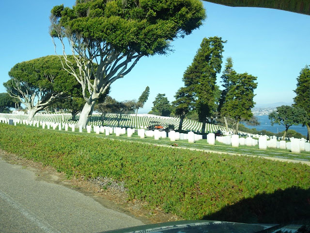
On the way back to San Diego, I took some photos of the military cemetery.  What a view from there!


On the way to our campground, we stopped for pizza.  I could not resist taking a photo of this apparently very overloaded car.  Is this all stuff heading to be recycled?


12/17 Anza Borrego State Park, Borrego Springs, CA

I have been here before, but it is a very scenic and peaceful place to spend a few days, so I invited a friend from New York to join me, so I am back for 9 days.  Because this is not quite the busy season, the campground had empty spaces.  However, the second day after we arrived, the power went out because of Santa Ana winds.  The county of San Diego and the power company wanted to make sure power lines that might fall would cause fires.  And this part of California is under a severe drought right now. 

However, I have a generator and good house batteries, so we did fine.  Power came back a little sooner than expected, so that was nice. 

The drive into Borrego Springs is over a range of mountains and steeply downhill for the last few miles.  In fact, I was not careful and my brakes ended up smoking a bit about 3/4 of the way down.  I called CoachNet, and they said it was OK to drive my vehicle as long as my brakes were working well, which they were. 

As you can see, this is desert, and there has been no rain here for many months.  Also too early for any cactus or other plants to be in bloom, but it is still a beautiful place.


Looking down to the small village of Borrego Springs.  The state park campground is only about a mile from the town, but a large part of the area is part of this very large state park.

A close-up of Borrego Springs.


The state park visitor center is mostly underground, with the entrance on the opposite side from the parking lot. 


There is a very nice paved sidewalk to the campground from the visitor center.  It is about 1/4 mile long

The campground in the distance.


Some large California palms.


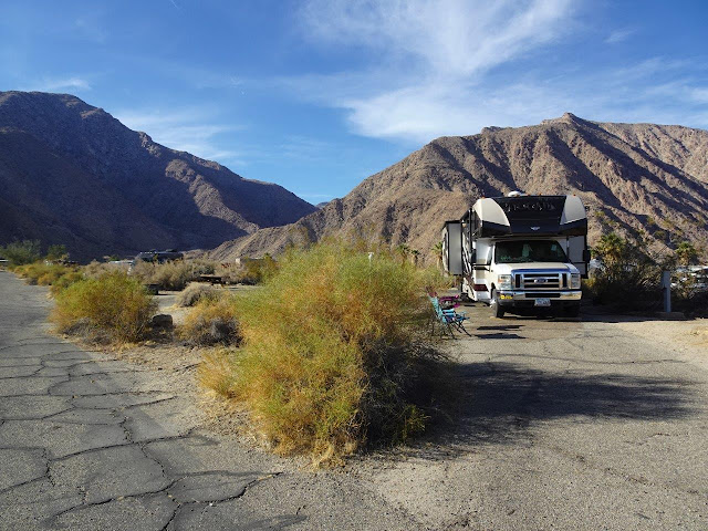
The campground itself. 


Individual restrooms and showers, but the showers take tokens--2 minutes for 25 cents. 

 
Two more, even bigger California palms.  They can be identified by their thicker stalks than the Mexican palms that are common in Florida.  

 
We drove back to San Diego by a slightly different route, but even it was beautiful.  A bit more curvy than I expected, but not too steep.  Only problem is that after a hour or so of this driving, your shoulders and arms get tired of steering around all the curves. 


Next stop today was Cabrillo National Monument, but I will post about that tomorrow when I am less tired!!