Monday, October 31, 2022

10/28 Merrill Campground, Eagle Lake, California

Eagle Lake is the second largest natural freshwater lake that is entirely in California.  Most of the "lakes" in California are really reservoirs because they were contructed with dams, but there are a small handful of "real" lakes in California, and this is one of them.  

If you have never heard of Eagle Lake, it is because it is way up in the far northeast corner of California, about 15 miles north of the town of Susanville.  It is also northeast of the Lassen National Park area.  I have been here before and love the big trees.  I was told, however, that the lake has some of the best rainbow trout in the state.  

It was VERY cold here, with nighttime temps dropping to about 22 degrees.  The state park, has three types of campsites--full hookup, partial hookup, and no hookup, so lots of choice.  

Here are some photos of the drive to the lake and the campground. 


Not a lot of traffic, as you can see, but there was a very large area of burned-over land.  I need to look up the name of the fire.   Just checked it out, and this was the 8,000 acre Hog fire in 2020. 


The road from Susanville is steep and winding, but I was able to take this quick photo of the lake in the distance. 


I had a partial hookup site because I was only there for one night.  Partial hookup means electric and water, but no sewer hookup.  

You can tell how big the trees are by comparing them to the size of my motorhome.  I will be back here again. 

10/23 More Gorgeous Oregon Coastline!

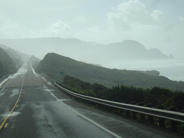
I have taken a lot of photo of the Oregon Coast, but I could not resist stopping and taking more photos in the fog and then when the sun came out.   No need to say anything more about them, other than the area south of Yachats is some of the prettiest coastline.

It was windy today, so the ocean was NOT very Pacific!


Finally, the sun came out. 


Sunday, October 23, 2022

10/18 South Beach SP, Newport, OR

This is a very nice state park close to the beach.  You do need to walk about 1,000' to get there, but there are several, nice, paved paths for walking or bikes.  I have been here before a couple of times and was planning on riding my bike around, but the weather has been really cold and windy, plus, I cannot find my bike key, so I have been spending a lot of time indoors catching up on reading and some chores. 

I don't know if it is because October is off-season and they are short of camp hosts and rangers, but the last several campgrounds have had absolutely no one manning the entrance booths.  Day use people need to fill out a form and put money in a slot, but campers with reservations have already paid for their sites, so we just need to go to our sites and get set up.  Nearly always, there will be a tag on the site with our names on it. 

This is my campsite, but I am not going to pick site B14 again because I had trees on both sides of me, which made it tough to get into.  Notice that the roof and rear of my vehicle is clear of trees, however.  I always choose sites where I can get a clear satellite view to the south so I can watch TV!!


Tuesday turned out to at least be sunny, so I decided to go for a long beach walk since I cannot ride my bike due to my missing bike key. 


The entire coast in the Northwest is wet and usually cool, so a lot of moss grows.  It reminds me of a lot of places in Florida where you also get moss on trees.

Finally, the beach!! 

This is looking north towards the jetty that protects the south part of the harbor entrance.

And this is looking south.  Not much this way for several miles.

I like walking during low tide because the hard sand is easier to walk on and you can see stuff that washes up better.  I am getting closer to the jetty, which is about 3/4 of a mile away.

 
The white thing is a large fishing boat that I saw in the Newport harbor the other day when I drove over the big bridge. 
 

Wish I could find the name of this ship so I could look it up and see what it is doing.

The large ship in the distance along with a smaller fishing boat.

A view standing on the jetty looking out in the ocean.

A lot of people use the jetty for fishing or just walking.  Lots of warning signs!

At this point, I decided I would walk to the main highway and stop at the nearby fish market.

It was a long walk along the roadway that goes from the jetty to the main highway, but I got to take this photo of a fishing boat and the lighthouse in the distance.


My walk to the fish market was a lot longer than I planned on, but here are some crab pots. 

Whew!  I estimate that so far I have walked over two miles, but I arrived at the fish market and ordered a fish sandwich and some clam chowder to take home. 


At this point, even after resting and having my fish sandwich and a Coke, I was really tired.  I did a lot of walking in London, but I am really out of shape.  I tried to get an Uber, but ended up walking another mile and a half to the state park!!  I may not be able to walk tomorrow because my muscles are already complaining.

I did want to post this sign I noticed in Newport a couple of days ago.  Somebody, at least, has a sense of humor.  I have not checked to see if U.S 20 actually does go to Boston!!

I have a pint of clam chowder which I am looking forward to for a couple of dinners or lunches in the coming week!! 

Tuesday, October 11, 2022

10/9 Cape Disappointment SP, Southwest Washington

Cape Disappointment was named that because several ships were sunk here on one weekend in 1853.   It is located on the northern side of the opening where the Columbia River empties into the Pacific Ocean, creating a lot of shifting sand bars and strong currents.  Here is a photo of one of those ships on its side. 

Cape Disappointment State Park is on a peninsula near the small town of Illwaco, which is on the other side of the Columbia River from Astoria, Oregon.  It occupies most of the lower half of the peninsula shown on this map:

I am a little sorry that I had scheduled four nights here because there was no cell service at all, which means I cannot use my Verizon hotspots for internet access.  It is amazing how often in a day you want to know something or contact someone and realize that without the internet we rely on so heavily, that you are out of luck. Also, the roads to the two lighthouses located here and the main interpretive center are closed to RVs, so I could not even visit these places without long, uphill hikes.  So, I was disappointed, as well, with this place.

Not too bad of a campsite.  It was paved and I had water and electric hookups, plus sewer.  Also, by pulling up to the front of my site, I was able to get satellite TV, which helped.  I spend much of my time here sorting through my UK booklets and reading the ones I had missed reading while on my trip.  I am taking them back to Ohio to store there. 


The first full day I was there, I decided to walk to the beach at the end of this road to see the ocean.  


Unfortunately, the fog was heavy, so while I could hear it, there was no ocean to be seen.  It was also cold and very windy, so I did not spend long here.

The mouth of the Columbia River is somewhere down this way. 

And there is a lighthouse down this way.

It is a VERY deep beach, so I could not even see the waves breaking on the shore at low tide.

Ah!  Day Two arrives with some sunshine!  So off to the beach again.


 MUCH better!  There is actually an ocean out there.


And I can see the peninsula with the lighthouse in the distance today.


Can't see the Columbia River from here, but at least I can see the whole beach in the distance.

It is a treat to occasionally see this flat ocean bottom during a very low tide.  It does not happen in very many places, but when the water rushes out, there are these hard sand areas with little rivers you can walk on.  You can walk out quite far by stepping over or jumping over the tiny streams of tidal water.  I did not even get my shoes wet!!


The water was clear and cold, and these gulls were taking advantage of this little sandbar to sit on.

Another view of the lighthouse from a viewpoint on the sandbar.

Any place on the Pacific shoreline of Oregon and Washington is covered with old logs from river flooding or as the result of logging.  The campground is beyond the logs, hidden by the forest.


The areas close to the coast receive not only the usual northwest rain, but they also get a lot of fog and the ocean presents a mild climate.  The result is a lot of ferns growing on the ground and a lot of moss in many trees.  In some ways, this reminds me of parts of Florida, except it is a LOT colder and windier!!

Tomorrow I head to Champoeg Historical State Park, just south of Portland, OR.