Thursday, April 29, 2021

4/26 Bandelier National Monument, Los Alamos, NM

 Bandelier National Monument is located in a mountain and series of canyons in Los Alamos, NM, but it is a strange place because in order to get to the monument, you have to drive up some steep roads past a lot of government facilities.  Los Alamos is where the atomic bomb was developed, but it now has a lot of government groups that search the universe for life and monitor electronic transmissions from who know where.  If ET wanted a place to land, this might be where he would choose!

Anyway, since the Bradbury Science Museum, the Manhattan Project Museum, and the National Museum of Nuclear Science and History were all closed, and the Los  Alamos National Laboratory was not offering tours, I decided to see how the ancients lived, before all these museums were in existence!  

I spend three days here in the campground, but got tired of not having any power, so headed down to the White Rock VIsitor Center RV lot.  Yes, I have parked in some strange places, but this place is cheap and has power, plus a water fill station and a dump station.  Normally, there are shuttles leaving the visitor center for Bandelier and other places in town.  It also has a grocery store and a couple of restaurants across the street, as well as a bus stop in front.  

This is my no-power campsite in Bandelier.  I was lucky to get one of the very few spots big enough for my motorhome.  Very pleasant, but was having problems charging my laptop. 

This is the camping area next to the visitor center.  Did I mention these were the only two places to camp within 20 miles? 

Bandelier National Monument is interesting because the ancient people lived here in two ways--in a pueblo built of stone in the flat area near the river and in homes dug out of the soft cliffs.  It is at about 7,000 feet, by the way. 

The visitor center was closed, but they had a ranger on duty who had lots of pamphlets available and was able to answer questions.  There was also a book/gift shop that was privately run that was open. 

There was about a quarter-mile paved trail to the ruins.

This was the cliff where there were holes dug out of the soft stone for homes. 

If you look closely, you can see some pictographs on the walls of one of these homes.  Some of the smaller holes were dug out and used as storage. 


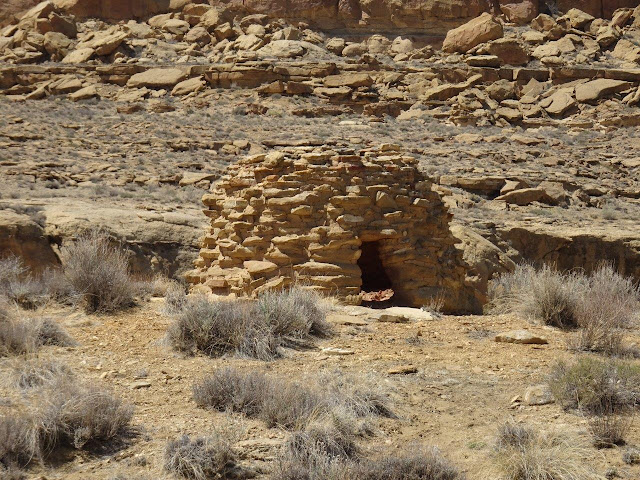
Here is a kiva, or ceremonial dwelling, next to the pueblo or village.  Every ancient Native American village had one or more of these used for religious or other ceremonial purpose.

You can tell the homes from the natural holes in the rocks by the rectangular shape.  They no doubt used existing holes and just dug them out more.

Next couple of photos show the pueblo or village of homes built on the flat land.  One big advantage of this location is that it was much closer to the river.  They no doubt had gardens and used the river for irrigation.  The path heads to the cliff and goes up among the homes built into the rocks. 


Here are several of the homes with ladders you could use to climb up to see inside.  No doubt the ancient peoples also used ladders they could pull up at night. 

A view from the cliff homes of the village below.  As you can see, these were so close that it is likely these were both part of the same extended families.

A view inside one of the cliff homes.  This one has a second room in the back and also a second story. 


Luckily, it was a cool and breezy day and I had brought water along.  Would not have wanted to do all this walking in the heat!!

You can see from the soot on the roof of this one that they had fires for warmth in here.


Another ladder to climb to this series of rooms. 

And a terrific view of the pueblo below.  I got tired of walking up and down, so was glad to head back across the river to my motorhome!! 


Monday, April 26, 2021

4/20 Chaco Canyon, Pueblo Bonito

This is the second half of my tour of Chaco Canyon.  Pueblo Bonito is the large dwelling that we usually think of when we think of Chaco Canyon.  In reality, there are several pueblos or villages that comprise this large group of communities, and this one is just the biggest.  Hard to believe that so many people lived here in these 800 rooms.  It was built in stages between 2 and 1126 AD.

One of the problems is that most of the photos you have seen of Pueblo Bonito were taken from above, so it does not look very impressive as you approach it on foot. 


The trail begins on the side of the pueblo and goes around behind it.  What is interesting is that many rock slides have either almost destroyed or did destroy much of the back of the semicircle.  How would you like to live here when these came down? 

You can begin to see the semicircular shape of the pueblo in this photo. 


What is surprising is the number of kivas in the center of the pueblo, and there are more that have never been uncovered. 

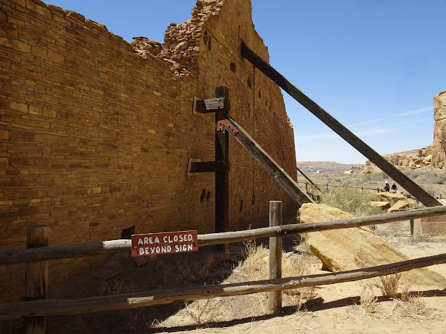
This wall was bulging and needed holding up.

Can't help it, but look at the varying colors of these lichen!!

Now, we have cut through the back wall and are looking at the many rooms inside.  Also, consider that this is just the first floors.  Many of these rooms had second and even third floors above them.


One of the many kivas.

I am in the center courtyard now.  Probably this was filled with areas where people worked under shaded shelters. 

And another kiva.


My archeologist tour guide said these corner windows exist no where else.  Not sure why they were built this way, but there are many in this pueblo.

The rows of beams show you where a floor/roof was for a second and third floor.


Saturday, April 24, 2021

4/20 Chaco Canyon, NM

 Chaco Canyon is a place I have wanted to go to for many years, but the road to the canyon is 18 miles of washboard gravel, and I do not want to cause any damage to my motorhome.  Last time I drove several miles on a gravel road, a piece of inside trim fell off inside my motorhome, so damage is likely.  

The reason the road to this national monument is not paved is because it goes through a Navajo reservation, and they do not want more people coming to the ruins and possibly causing more damage.  These ruins were uncovered over 100 years ago, after having spent several hundred years mostly covered with desert sand.  Uncovering the ruins meant that they were not open to the weather and archeologists digging for remnants of the past.  Plus, the stones were originally held together with mud, which got soaked in rains and was repaired with cement.  In fact, large parts of some walls that are visible today were reconstructed with cement to hold stones together, which means not all the walls are original. 

While being able to see this unique ruin is important to understanding past native cultures, from the Navajo's perspective, this was damage.  Hence, they will not allow the road to be paved so more people can visit.  

So, I decided that this year, I would take advantage of the private tours offered through the nearby Salmon Ruins museum.  They drive four-wheeled vehicles and provide water and lunch.  It was expensive, but the drivers are degreed archeologists, so they are very knowledgeable.  

Because I have so many photos, I have broken this posting into two pieces.  The first is the several ruins that are in the area, and the second is the largest of the ruins, Pueblo Bonito. 

This is the closed visitor center.  It is disappointing to not be able to visit, but that is the case this year with a lot of national park visitor centers because of COVID-19.

This area is extremely dry, but when the ancient peoples lived here, there was water in a nearby river because the water table was much higher.  The area around Chaco Canyon supported several thousands of people.   However, in the 13th and 14th Centuries there were several multi-decade long droughts that made life much harder.  Eventually, the many pueblos in this area were abandoned.  There are Navajo people living in this area, but they came from eastern areas and are not the descendants of the people who once lived here.  They pueblos got covered with sand until they were discovered in the late 1800s.  Here are some places to find more information on these peoples:

  • https://www.nps.gov/chcu/learn/historyculture/index.htm
  • https://en.wikipedia.org/wiki/Chaco_Culture_National_Historical_Park

When the White man came and started digging well and using river water to irrigate crops, the water table dropped and the river became dry.

One of the interesting things about this area is the variety of stonework.  Some of it is very old and some slightly less old.  Notice that this wall is constructed of mostly fairly large stones on either side with rubble in the middle.  Basically, they used what was nearby and available.

These walls are made from a lot of smaller, flatter stones.  They would have used mud as mortar. 

Most walls in this area were flat on the outside and inside.  Sometimes this required knocking off the rough edges of stones.  Notice the shape of the door and the location of some small windows.

They chose a location with a great view.  The formation on the right was a marker that helped people find their way across a flat desert. 

Most of the dwellings were built backed up to this or a similar cliff.  Maybe to break the wind??  No one knows.

Rows of logs indicate the places where a second story was located.  The logs also allow the walls to be dated.

Another pueblo.


These two walls have alternating large and smaller stones. 

Each pueblo or "great house" would consist of many, many small rooms and were probably occupied by extended families.  Each had at least one large kiva, or ceremonial pit house.  The two big holes probably held two large trees that supported a roof.


It was a cool and sunny day, with a nice breeze--very pleasant.  You will note that for a lot of reasons, there were not a lot of other people visiting here, which was nice.  

Next posting will focus on Pueblo Bonito, the large semicircular pueblo you see a lot of pictures of.