Monday, October 29, 2018

10/28 Shasta Lake to Mt Shasta, CA - Fire Damage

Interstate 5 is the main north-south freeway in California, going all the way from the border with Mexico to past Seattle.  Heading north from Napa, most of the route is through the Central Valley, which is mostly flat and hot and consists of farmland.  Once you get past Redding, however, you enter the mountains and the elevation rises sharply.  If you remember from the news this summer, Redding was one of the hardest hit places when the fires were burning, but most of the damage to Redding was west and north of the city.

There were also separate fires in the areas just past Lake Shasta, north of Redding.  These fires closed the interstate for several days with fires on both sides of the highway, in an area about 10 miles long.  If you remember, people had to drive 200 miles to get north because of the closed freeway.  

This is beautiful, heavily forested, mountainous land. 


The lake is substantially down because it is October and the rains have not yet started. 


The brown trees shown on the right are not changing color because it is fall.  They have been damaged by fire. 


There are still patches of unburned trees, luckily. 

The next few photos show substantial fire damage. 

In the heavily burned areas, they are cutting and removing all burned trees and shrubs from the interstate right-of-way.  I assume this is being done to reduce the availability of fuel in case another fire comes. 


They are also repairing the hillsides and trying to prevent rains from washing out some areas. 


This burned area goes for at least ten miles.  It must have been a spectacular fire.  Notice that the hills and mountains in the distance are also burned. 


Notice the stumps remaining where they have removed the trees.   

Piles of burnt trees and undergrowth. 

The very wide shoulders here are chain-up areas because this area gets heavy snow during the winter.  If the signs indicate I need to put chains on my RV, I can guarantee you I will do a quick exit or u-turn and head back down the mountain to wait it out!  

More burned area.  I just got tired of taking photos, but it was amazing how much here was burned.  And notice how spotty it was.  There would be a small burned area, then some green trees that were untouched, and another burned area.  The top of the mountain to the right is really black. 


10/27 Napa EXPO RV Park

I've been spending the last week or so in Napa, visiting family.  My favorite place to stay in Napa is at the county fairgrounds, aka the EXPO, where there is a very nice RV park.  It is really the only decent place to stay within maybe 30 or 40 miles because it has very large paved RV sites with full hookups.  It is a tad expensive, but worth it because it is only 4 blocks from downtown and other city attractions like the wine train and tons of restaurants. 

Another advantage is that there is a small laundromat tucked into the shower and bath building.  I never use the public facilities provided with campsites, but I do like the laundry because it is so close. 

There are also two camp hosts next to the facilities building.  Camp hosts are responsible for checking you in, maintaining the grounds and restrooms, and making sure guests follow the rules and don't get carried away with late night wine parties!  You can see my front bumper in the right lower part of the photo, which means I am very close to the laundry.  And in fact, I did four loads while I was here. 

I had to pull my rig as far forward in my site as I could because the trees were blocking my satellite TV signal.  You can see how much space there is behind my motorhome--enough for another RV.  In fact, during the county fair and the annual Bottlerock Festival, they put two rigs on each site and two more in between, so there will be as many as four RVs in the same space taken up by one during the rest of the year!  The camp hosts keep their spots, but the entire fairgrounds is rented out for Bottlerock, and the camp hosts have told me they will be moving out next year!!   

Here is a video showing the premium ticket suites!  https://www.youtube.com/watch?v=3uvzI7cP8As.  They build huge grandstands for this event, with half a million people attending.  

And here is another video of the festival:  https://www.youtube.com/watch?v=I1pdQ53oi64 

The camp hosts also told me that they have to completely re-sod the fairgrounds afterwards because of all the crowds!  

Anyway, most of the time it is much quieter here.   

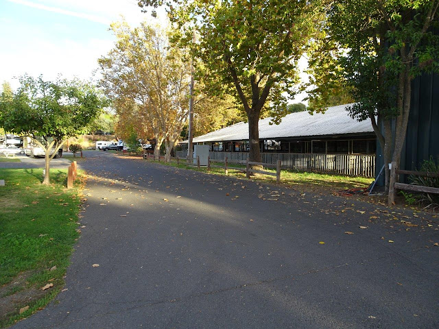
Looking from the front of the campground to the back.  There are only 28 sites, so it is full almost every day of the year. 

No campfires and no tents are allowed.  You also may not put any mats on the grass. 

My site this time was next to the cow barns.  No cows or any other animals, however. 


Most people stay only a couple of days, so during the day, it is about half empty, but this photo was taken in late afternoon when it was full. 

 Another nice thing about this campground is that I can ride my bike through the fairgrounds and out onto the bike trail along the main road for a couple of blocks, and then catch the bike trail that follows the wine train tracks.  It will take me to the other end of town where if I wanted to, I could get on the 20+ mile trail to Yountville. 
 

Thursday, October 18, 2018

10/17 Emigrant Lake Recreation Area, Southern Oregon

I am staying at this very pleasant campgrounds for a few days as I work my way south to Napa, California, to visit family.  I've been here a couple of times before because it is a nice place not too far off of I-5, which is the major north-south freeway from California to Washington state.   

The drive from Eugene to Medford, near Emigrant Lake, goes through forested mountains surrounding Mt Shasta and Grants Pass, so maybe a bit of snow in winter, but it is a very pretty drive.  

 Emigrant Lake is usually full of water.  (It has also been mostly full of smoke for the past year because this is one of the hardest hit fire areas, but that is another story.)  Right now, the fires are mostly out, but the lake is almost dry, the water from the past year having been pumped out for agricultural uses.  It will fill up again in the winter, but here is the overflow area--not much to overflow right now!

The row of RVs is usually on the shore of the lake. 

There is a second row of camping spots behind this row and about 20' higher, so all sites have very good views. 

Just a large puddle right now!  

It's a very long drive down the boat ramp to the lake.  And really, the only boats I saw in the last few days were a couple of canoes and a rowing team practicing.  You can see where the lakeshore normally is by the lack of vegetation. 

There is one car way down at the bottom. 

There are actually two campgrounds on this lake and a water slide.  My campground has paved sites and full hookups, but the other one is dry camping only, meaning to water or electric hookups.  It is closed for the season, as is the water slide. 


I used my telephoto lens to take this photo of my rig in the distance. There are about 30 sites full hookup sites, and the camphosts told me that even if it is only 50% full, this is the busiest they have been all summer, due to the smoke conditions.  They even closed the water park most of the summer because smoke levels were hazardous here. 

Another photo of my campsite on the upper level.  Good cell service, and hence good internet access here, plus an easy satellite signal--all things I value!

My reservation in the upper loop ended today, so I decided to try one of the lower sites that had a better view of the lake.  I claimed this site and then headed to town to get some groceries.  This was taken in very late afternoon, so very long shadows.  

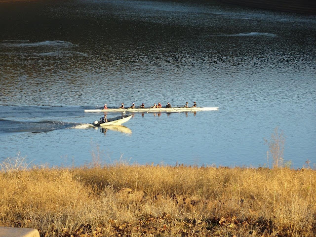
I had noticed on my way in here a few days ago that there was a rowing club boathouse and stacks of boats parked on the other end of the lake.  They are very long, but not much more than 15" wide.  Here is a crew practicing.  Note that the person in the rear is not rowing.  Instead, she is calling out instructions to the rowers, who all looked pretty young.  There is a college in town, so I assume this is a college group. 

And the guy in this little boat had some sort of megaphone that he used to give them directions.  The rowing boat looks at least 50' long, I am guessing.


Almost sunset, so time to head home from my short walk. 


Most campers this time of year are older retirees, with a few younger people on long vacations tossed in.  That makes for a very quiet group.  


Sunday, October 14, 2018

10/12 Not Much to Post These Days

I am still in Oregon, but catching up with doctor's appointments and tests, so have not been traveling much, hence no postings lately.  Also, just taking it easy.  

One issue with full-timing is staying somewhere long enough to take care of medical issues.  For ordinary sore throats and colds and such, I just stop into a local urgent care center. I also have an internist who handles my basic things in Ohio, an orthopedic surgeon near where my son lives in northern California who did carpal tunnel surgery on my right hand a few years ago and trigger finger releases on my left hand. 

Since I am a kidney stone former and have been having some symptoms of kidney stones lately, I need to see a urologist soon.  I had a lithotripsy treatment from one in northern California a few years ago, but was unhappy with him, so I think I will see one here in Oregon when I come back in a couple of weeks. And I really need to see an ophthalmologist, so finding one is on my list.  

The older I get, the more specialists and more appointments, unfortunately!  

One thing I do is to carry around copies of all lab test results so I don't have to needlessly repeat things.  And because I live and travel alone, I keep a one-page document in my purse and in a prominent place in my motorhome that lists my medical contacts and the phone numbers of my kids, plus a list of medications I take and a brief medical history.  That is in case I pass out of something and 911 is called.  It is also handy to give to new doctors if I have to go to urgent care or an emergency room. 


I will be heading south to northern California to visit with family soon, so will do some postings then. 

Friday, October 5, 2018

10/3 Thomas Condon Paleontology Center, John Day Fossil Beds National Monument

Amazing.  I went over a week without posting because I had nothing to post, and now I have too much to post!

Anyway, here the second part of October 3rd.  My big stop this day was the visitor center which is named after the person who did most of the collecting here in the 1800s and who was the first State Geologist in Oregon. (Unlike John Day, he came to Oregon later in the century and so did not get robbed of his belongings and clothing by the natives.)

I have been to a lot of museums and visitor centers in my six years of travel, but I was really impressed by this one and learned a lot I did not know about this area.  First, there are three parts to this national monument that are widely separated.  That is because the monument encompasses three unique fossil areas.  The main one where the visitor center is located is called the Sheep Rock Unit. 

Oregon has some unique fossil collecting areas because of the number of volcanoes and eruptions of ash that covered and protected the plants and animals that lived between 54 million and 20 million years ago.  

Not a huge museum, but big enough and nicely done. 

The view from the patio shows some of the areas which are still being explored today.  Only about 3% of the fossils here have been found, so there is still lots of digging by students and researchers. 


This shows you where the various layers are located.  You can see how large an area these cover. 


The oldest area is the Clarno nut beds.  After volcanic ash became saturated with water, it was common to have lahars, which are mud slides that pick up and carry trees and plants. At the bottom of a mud slide, fossil hunters have found concentrated areas of early trees and plants.  Some examples of these early trees and plants are shown in the photo two slides below. 


The next era was the Hancock Quarry, about 40 million years ago. 

There were some strange-looking mammals back then, including some that looked like rhinos and other animals that live in wet and hot areas now. 

More recently, at about 33 million years ago, was the Bridge Creek Flora area.


The Turtle Cove period was about 29 million years ago.

And the Kimberly era was about 24 million years ago.

And the Haystack Valley era was only 20 million years ago.

I could have spent more time, but I was worried about getting a camping spot for the night.  I will come back here maybe next spring or summer.