I am breaking my trip to Mackinac Island into two parts because I took so many photos of homes and hotels. This first part will include the ferry ride and the main village area.
The important thing to know about this island is that no motorized vehicles are allowed, including electric bikes unfortunately. You can rent a bike on the island or bring your own. The ferries charge a fee for bikes, but it is a lot cheaper than renting one. This area on the ferry is for bikes and luggage for people staying overnight on the island.
Masks are required on the ferries at all times and in all stores on the mainland or the island. You don't wear a mask--you get kicked out. One thing to remember is that this part of northern Michigan is very isolated during much of the year, and has had almost no Covid 19 cases. So, hoards of tourists from the cities and other states are a serious hazard to the residents and employees, to say the least for the visitors themselves. I was very happy to see everyone wearing a mask.
Some of the morning ferries take a slightly longer path and go underneath the Big Mac bridge. West of the bridge is officially Lake Michigan, and east of it is officially Lake Huron.
The Grand Hotel. Very expensive, but a once-in-a-lifetime experience to stay in a historic building. Also, once the day-tourists, or "fudgies" leave, the island is a different place.
The main village on the island. The fort that protected the fur traders from the British and others is on the upper right.
The Island House hotel--the second oldest hotel on the island. I stayed here with my family many years ago. The houses on the ridge behind it are among the few private homes on the island. Incredibly expensive, as well!
Main street with shops, restaurants, and a lot of bikes.
A tour carriage. Tip: If you want to take a tour, buy your ticket as soon as you arrive because they sell out fast.
The next two photos are of drays. These are freight wagons that haul just about everything. Live on the island and need a new refrigerator? It has to come by ferry and then be delivered by dray.
Fort Mackinac was built by the British in 1780, but the island had been used by Native Americans for centuries. A mission was founded here in 1670 by Father Jacques Marquette.
A taxi, but these also get booked up in advance.
The results of 300 horses that reside on the island. Need a summer job? You can get one as a street sweeper of horse droppings.
Another dray wagon.
And the far west end of town looking at the lake.
One of the popular hotels of the west end of town.
Heading home on the ferry to Mackinaw City.
The houses on the bluff are all privately owned and incredibly expensive to purchase, assuming one might go up for sale. Mostly, they are passed down through families. I tried to take a taxi for a ride past these houses, but gave up waiting for it to arrive.
Driving north on the bridge. Little scary because of the winds, however.
Saturday, June 27, 2020
Friday, June 26, 2020
6/24 Mackinaw City & Wilderness State Park, MI
Unless you have traveled to Michigan, you may not have heard of Mackinaw City. It is the top-most city on the northern tip of Michigan's lower "mitt." It is a pretty small village and extremely empty during the winter, but it comes alive in late spring with tourists heading across the "Big Mac" bridge to the Upper Peninsula or to Mackinac Island.
(Note that the city is spelled with a "W" at the end and the island is spelled with a "c" at the end. This is because the English settled in the city and the French settled on the island. Both places were fur trading locations and stopping places for hundreds of years for Native Americans. Both places are pronounced "aw" at the end.)
About ten miles west of the village and along Lake Michigan, you will find Wilderness State Park, which is where I am staying for three days.
This is the new, full hookup area. No room for me there, so I drove up the hill to another area.
A quick view of Lake Michigan. Note the lack of a beach. Water levels on the Great Lakes at record high levels, so hardly any beaches anywhere on any of the lakes.
I had expected it to rain all day today, but around noon, it started to clear up, so I packed everything up and headed into Mackinaw City to get some fudge. First stop was the parking area just under the bridge, which is part of Fort Michilimackinac State Park. I knew from past trips up here that there was excellent RV parking in the fort's parking lot next to the bridge, so I stopped here.
This is the pretty little park next to the bridge. Always a pleasant place.
This is the Big Mac bridge. It was completed in 1957 to tie Michigan's lower and upper peninsulas together at what is known as the Straits of Mackinac. Previously, you had to wait in hours' long lines to take a car ferry across the straits. From shore to shore, the bridge is five miles long and very scary to drive in high winds.
One thing I really miss in my travels are lilacs. Found this bush in full bloom in the middle of a roadway.
This is the very pleasant village of Mackinaw City. About half of the stores and restaurants were closed, but it was nice anyway.
There are several large ferry companies in Mackinaw City and in St. Ignas on the other end of the bridge. They take visitors to Mackinac Island for day trips or for longer stays at hotels and bed and breakfasts.
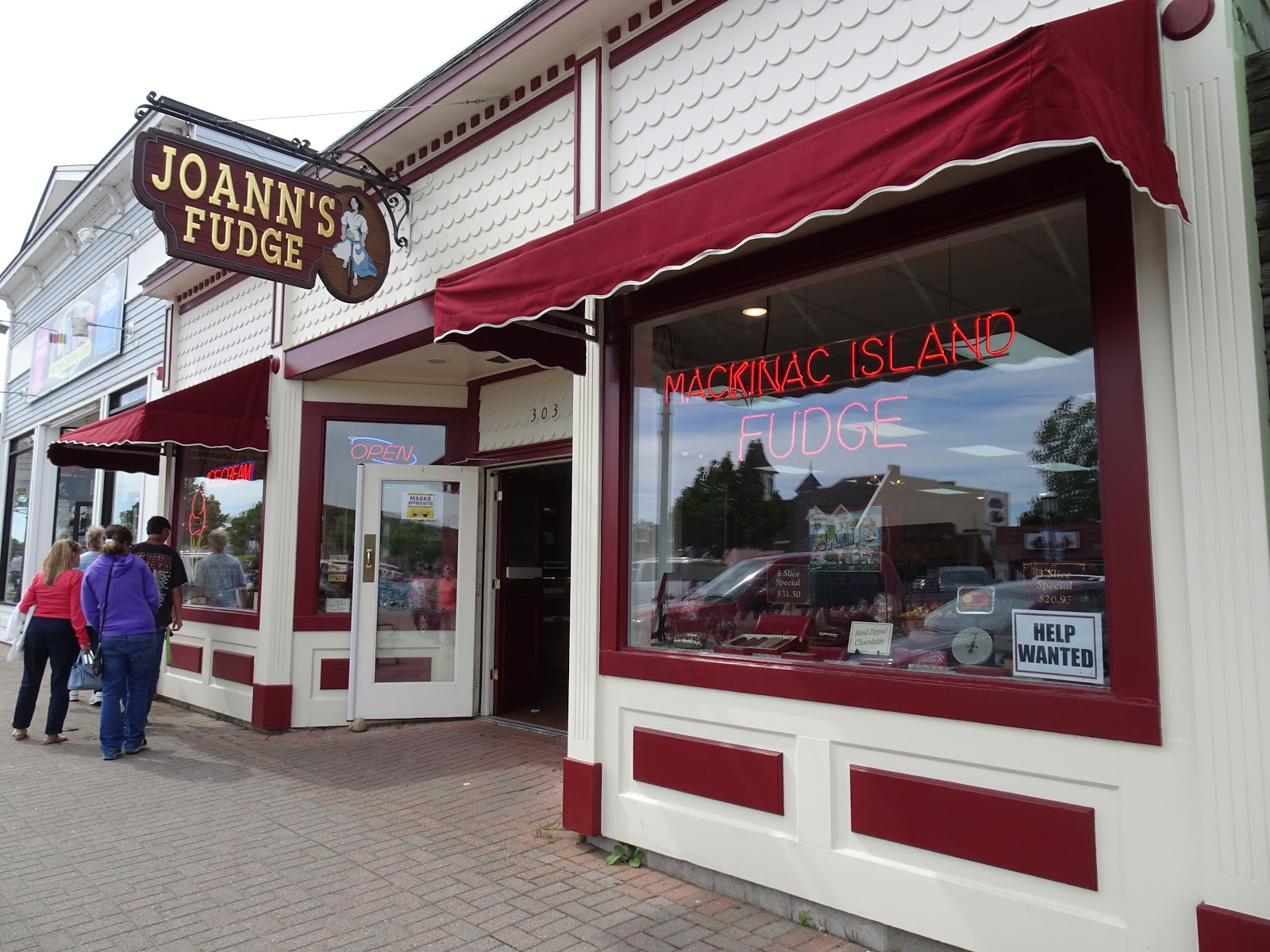
Ah, my favorite fudge place!!
And a few of the choices of fudge flavors.
I got a slice of double dark pecan, double dark chocolate, and double dark cherry and pecan.
(Note that the city is spelled with a "W" at the end and the island is spelled with a "c" at the end. This is because the English settled in the city and the French settled on the island. Both places were fur trading locations and stopping places for hundreds of years for Native Americans. Both places are pronounced "aw" at the end.)
About ten miles west of the village and along Lake Michigan, you will find Wilderness State Park, which is where I am staying for three days.
This is the new, full hookup area. No room for me there, so I drove up the hill to another area.
No lake view up here, but it was open and breezy to keep mosquitoes at bay, and I got some satellite TV. 

A quick view of Lake Michigan. Note the lack of a beach. Water levels on the Great Lakes at record high levels, so hardly any beaches anywhere on any of the lakes.
I had expected it to rain all day today, but around noon, it started to clear up, so I packed everything up and headed into Mackinaw City to get some fudge. First stop was the parking area just under the bridge, which is part of Fort Michilimackinac State Park. I knew from past trips up here that there was excellent RV parking in the fort's parking lot next to the bridge, so I stopped here.
The fort is a reconstruction, but I like the Michigan products sold at the visitor's center, so I headed over there to look around. Did not buy anything, but I like how it is tucked under the bridge.
This is the pretty little park next to the bridge. Always a pleasant place.
This is the Big Mac bridge. It was completed in 1957 to tie Michigan's lower and upper peninsulas together at what is known as the Straits of Mackinac. Previously, you had to wait in hours' long lines to take a car ferry across the straits. From shore to shore, the bridge is five miles long and very scary to drive in high winds.
A couple of photos of some of the exhibits. There are more in the fort, but it was closed.
One thing I really miss in my travels are lilacs. Found this bush in full bloom in the middle of a roadway.
This is the very pleasant village of Mackinaw City. About half of the stores and restaurants were closed, but it was nice anyway.
There are several large ferry companies in Mackinaw City and in St. Ignas on the other end of the bridge. They take visitors to Mackinac Island for day trips or for longer stays at hotels and bed and breakfasts.
Ah, my favorite fudge place!!
And a few of the choices of fudge flavors.
I got a slice of double dark pecan, double dark chocolate, and double dark cherry and pecan.
If the weather is OK, I may go to the Island tomorrow.
6/5 Camping on the Ohio Turnpike
It is hard to believe, but the Ohio Turnpike is one of the few freeways in the U.S. that has parking areas for RVs that are equipped with electric hookups for each RV, and dump stations and water fill stations available. They are located on both sides of the turnpike and at about every other service area. Cost is $20 cash, and you must have the right change. Credit cards are NOT accepted!
The neat thing is that if you are traveling and don't want to get off the turnpike to search for a site, this is very convenient. However, you cannot stay more than one night and have to be off the turnpike within 24 hours after you entered it.
Here is a map of the Blue Heron Service Plaza southeast of Toledo. The RV overnight lot is in the upper far right. Next to it is the employee lot.
This lot has all pull-through spots. They are wide, but lengthwise will fit only a 35' long rig. If you have a tow vehicle, you will have to unhook and park it next to you.
Just another view. You can see the food court in the distance.
This is the drinking water fill. You need to attach your own hose and try not to spray water all over yourself since the faucet is one of the 100% on or 100% off versions.
The neat thing is that if you are traveling and don't want to get off the turnpike to search for a site, this is very convenient. However, you cannot stay more than one night and have to be off the turnpike within 24 hours after you entered it.
Here is a map of the Blue Heron Service Plaza southeast of Toledo. The RV overnight lot is in the upper far right. Next to it is the employee lot.
This lot has all pull-through spots. They are wide, but lengthwise will fit only a 35' long rig. If you have a tow vehicle, you will have to unhook and park it next to you.
Just another view. You can see the food court in the distance.
This is the drinking water fill. You need to attach your own hose and try not to spray water all over yourself since the faucet is one of the 100% on or 100% off versions.
This is the sewer dump station. Just the usual sewer connection and a rinse hose.
This is a photo of one of the other RV areas, except this one is back-in, which would make it less convenient for trailers being towed or motorhomes towing a car. Sunday, May 24, 2020
5/24 Cedar Point by Boat
No, unfortunately Cedar Point Amusement Park is not open, but I am in finally in Ohio visiting my younger son and his family, so he took me for a boat ride today. The only part of the park open is the marina, so it was nice to ride past it and at least see some life there.
This first photo is of the park from Sandusky Bay.
Lots of roller coasters, but nothing moving.
And the view from the marina. The marina was the only place where there was any activity. In the background is the Power Tower,
Good photo of a very quiet Magnum Force Roller Coaster.
Having trouble identifying the rest of these.
Leaving the marina and Cedar Point.
By the way, because Lake Erie water level is so high, there is water lapping up on the parking lot. Hopefully, it will be lower by the time the park opens this fall or next spring.
This first photo is of the park from Sandusky Bay.
Lots of roller coasters, but nothing moving.
And the view from the marina. The marina was the only place where there was any activity. In the background is the Power Tower,
Good photo of a very quiet Magnum Force Roller Coaster.
Having trouble identifying the rest of these.
Leaving the marina and Cedar Point.
By the way, because Lake Erie water level is so high, there is water lapping up on the parking lot. Hopefully, it will be lower by the time the park opens this fall or next spring.
Subscribe to:
Posts (Atom)