I was on my way to another campground, and parked not too far away from Sol Duc Falls. Once again, Ron and Jan picked me up and drove us down the long road to the falls.
This is really beautiful northern rain forest. Hard to take photos of such large trees.
This is a rocky area, no doubt created when water washed away the sand and dirt from among the rocks. Many of the rocks are now covered with moss. Pretty.
And Sol Duc Falls, themselves. This is a fault or crack in the earth where the river falls down the crack, producing a multi-stream waterfall.
This plant in bloom is called Devil's Club. It has sharp spines that dig into your flesh and cause swelling and possible infection. I had never seen it in bloom before, but it is definitely on the Do Not Pick the Flowers list!
And here I am by the falls, looking a bit rumpled and worn out.
Just more pictures of the falls and hiking path.
Weather here, by the way, has been cool and damp with lots of morning and sometimes even afternoon fog. Highs have been in 60s, so good weather for walking. Hard to get a suntan around this place!
Saturday, August 16, 2014
8/13 Salt Creek Recreation Area, WA
Salt Creek is a county park and campground about 15 miles west of Port Angeles. It is very convenient to much of the Olympic Peninsula, but the real reason for staying here is the incredible view!
The only problem I had was that Canada was right across the sound, so that I could not use my cell phone or mobile hotspot without roaming and incurring hundreds of dollars of charges. I ended up driving into Port Angeles to contact my students. They had good cell service there so I did not pick up any international roaming.
The tide pools were a scramble down a bunch of rocks, and since I was only here for three days and it rained all of one, I did not make it down there.

Here is one of the very tame local resident black-tailed deer. He is a young buck, by the looks of his small, growing antlers.
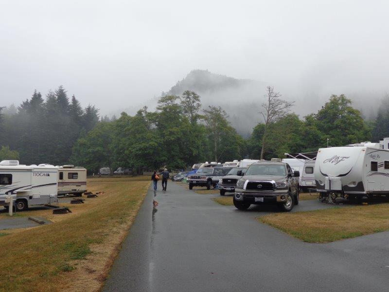
Foggy and rainy campground! I liked the paved roads and asphalt camping pads, and also the fact that almost all sites faced the ocean.
The only problem I had was that Canada was right across the sound, so that I could not use my cell phone or mobile hotspot without roaming and incurring hundreds of dollars of charges. I ended up driving into Port Angeles to contact my students. They had good cell service there so I did not pick up any international roaming.
The tide pools were a scramble down a bunch of rocks, and since I was only here for three days and it rained all of one, I did not make it down there.

Here is one of the very tame local resident black-tailed deer. He is a young buck, by the looks of his small, growing antlers.
Foggy and rainy campground! I liked the paved roads and asphalt camping pads, and also the fact that almost all sites faced the ocean.
8/11 Neah Bay, Olympic Peninsula, WA
Thank you, McDonalds! I am having Verizon Jetpack problems so catching up using their free WiFi. Hope it works.
Neah Bay is as far northwest in the United States you can get without getting very wet. My friends Ron and Jan picked me up at the campground and took me out here for a hike. They live out here in Port Angeles, but I knew Ron from high school and Jan from the reunion planning group.
There is an excellent Native American Museum at Neah Bay containing artifacts dug up in the area and owned by the tribe. We stopped there and then had lunch before going to the hiking area.
Isn't this a weird tree???
It's about an .8 of a mile easy walk out to the very end of the point of land.
This is a small island in the distance.
And me, almost in the Pacific Ocean.
Can you see the seals on this piece of rock?
I took a close-up of this mother seagull and her two chicks. They are very hard to see because they are so well hidden by their spotted coats. Look for legs.
Neah Bay is as far northwest in the United States you can get without getting very wet. My friends Ron and Jan picked me up at the campground and took me out here for a hike. They live out here in Port Angeles, but I knew Ron from high school and Jan from the reunion planning group.
There is an excellent Native American Museum at Neah Bay containing artifacts dug up in the area and owned by the tribe. We stopped there and then had lunch before going to the hiking area.
Isn't this a weird tree???
It's about an .8 of a mile easy walk out to the very end of the point of land.
This is a small island in the distance.
And me, almost in the Pacific Ocean.
Can you see the seals on this piece of rock?
I took a close-up of this mother seagull and her two chicks. They are very hard to see because they are so well hidden by their spotted coats. Look for legs.
Saturday, August 9, 2014
8/7 Whale Watching Tour to San Juan Island
Jan and Ron picked me up at 8:00 am and we headed to Port Townsend to take the all day whale watching tour. The start was foggy, and calm in the harbor, but got very rough as we headed out. (I do not have very good luck on whale watching tours.) I have never in my entire life and three North Atlantic ship crossing ever been seasick, but I really got seasick today!! It started out with a cold sweat and quickly moved to needing some Dramamine and an sick bag. Whew!
All in all, however, it was a great day. The fog blew away and we joined a bunch of other tour boats watching these Orcas or killer whales.
Don't you think there are too many people on this boat?? Here are at least three whales. One was a baby, but it was very hard to get photos of them all on the surface, so I don't know which was which.
Headed into Friday Harbor for lunch and wandering around.
Good picture of my friends.
It was a LOT calmer on the way back, and I was happy not to get seasick again. The tour boat took us past several rocky outcrops where birds and seals were hauled up.
And an American Eagle!
This back at Fort Worden, going past the lighthouse and keeper's home. The campground is directly behind these, but hidden.
It was an eventful day, and I was happy to be home in my motorhome and just resting. Very light dinner tonight!!
All in all, however, it was a great day. The fog blew away and we joined a bunch of other tour boats watching these Orcas or killer whales.
Don't you think there are too many people on this boat?? Here are at least three whales. One was a baby, but it was very hard to get photos of them all on the surface, so I don't know which was which.
Headed into Friday Harbor for lunch and wandering around.
Good picture of my friends.
It was a LOT calmer on the way back, and I was happy not to get seasick again. The tour boat took us past several rocky outcrops where birds and seals were hauled up.
And an American Eagle!
This back at Fort Worden, going past the lighthouse and keeper's home. The campground is directly behind these, but hidden.
It was an eventful day, and I was happy to be home in my motorhome and just resting. Very light dinner tonight!!
Friday, August 8, 2014
8/5 Olympic National Park, Hurricane Ridge
This day I drove to Port Angeles to have dinner with some old friends from high school. They kindly drove me up to Hurricane Ridge, named obviously for the strong winds. Check out the very tame deer. I think I could have reached out and petted a couple. No fear whatsoever.
Here are my friends, Jan, Ron, and me on Hurricane Ridge.
I liked this map of the Olympic National Park because it shows how the mountains are really a jumble of inaccessible peaks, except that Jan and Ron have actually climbed one of these!!
I'll be driving up to some of the other areas within the National Park next week when I will be staying closer to Port Angeles.
Here are my friends, Jan, Ron, and me on Hurricane Ridge.
I liked this map of the Olympic National Park because it shows how the mountains are really a jumble of inaccessible peaks, except that Jan and Ron have actually climbed one of these!!
I'll be driving up to some of the other areas within the National Park next week when I will be staying closer to Port Angeles.
8/4 Port Townsend, Fort Worden State Park
Fort Worden is an old fort at the very northeastern tip of the Olympic Peninsula, overlooking Puget Sound and the Straits of San Juan. The road goes west of Tacoma and over the location of the old "Galloping Gerty" bridge. Luckily the new bridge does not gallop.
After many miles of woods, you enter Port Townsend down a hill with an open view of the sound. Pretty!
The state park is an old army fort and has a lighthouse at the very tip, just past the lower beach campground. It is supposed to be open for tours on Saturday, so I will be heading there on my bike.
In this photo, you can see how the lighthouse and campground (hidden behind the dunes) is on a narrow spit of land. You can see Puget Sound on the right and harbor for Port Townsend on the left in the far distance.
There is also a Marine Science Center on the state park pier.
Some of the residents.
Just a couple of the old fort buildings. Will get more pictures later in the week. Look how blue the sky is!
After many miles of woods, you enter Port Townsend down a hill with an open view of the sound. Pretty!
The state park is an old army fort and has a lighthouse at the very tip, just past the lower beach campground. It is supposed to be open for tours on Saturday, so I will be heading there on my bike.
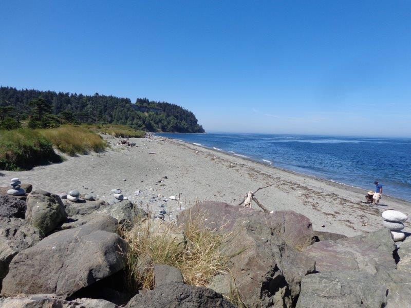
Small beach, but very pleasant. Weather here has been with highs in the upper 60s and low 70s, but very sunny with a nice breeze. Cool at night for sleeping. Perfect weather for my tastes.
In this photo, you can see how the lighthouse and campground (hidden behind the dunes) is on a narrow spit of land. You can see Puget Sound on the right and harbor for Port Townsend on the left in the far distance.
There is also a Marine Science Center on the state park pier.
Some of the residents.
Just a couple of the old fort buildings. Will get more pictures later in the week. Look how blue the sky is!
Subscribe to:
Posts (Atom)