Friday, December 8, 2017

12/6 Death Valley Ubehebe Crater

Ubehebe Crater is the remains of a volcano that erupted here about 2,000 years ago, which is relatively recent in geologic times.  The ranger at the visitor center said the valley was formed by the mountain ranges on each side sliding past each other and at the same time pulling apart.  Today, I headed off 50 miles north of Furnace Creek to see the Ubehebe Crater.  I had been here several years ago, but it was so cold and windy that day, I could hardly stand around to take photos.  Nice drive, anyway.

I just love driving here.  You hardly see any other cars.  However, today I saw a group of cyclists!  I think I prefer something with a motor.  Look how loaded down their bikes are.


Another wonderfully empty road!  

The valley is relatively young, but it is full of sand and gravel that have washed out of the nearby mountains, creating these "aprons."


The terrain gets a little rougher in the north end of the valley. 

Nice arial map!

The main crater is about a half-mile across.  The hiking trail goes around the top edge of the crater and is about 1.5 miles long.  Since it is very slippery pea gravel, I decided it was not safe for me to walk on that far. 

It is possible to walk down to the bottom, but the path is pretty steep, so I bypassed that as well.  Wish I were younger and in better shape. 

This shows the path down to the bottom. 


I did walk partway up the trail.  In the distance is road to the famous "Racetrack" where the rocks move, but it is more than 20 miles away down a dirt road, so not appropriate for either me or my motorhome.

Can you believe that parts of this valley are up to 9,000 feet deep with sand and gravel washed down from the mountains.  It would be a very impressive valley if we could see all of it. 

This shows the path around the northern part of the crater wall. 

Headed down the slightly scary and narrow road back off the crater. 

Last winter, there was a flash flood down the canyon where Scotty's Castle is located. It washed out the road, so it will take more than a year to repair.  


The white concrete roadway beyond the "dip" sign is where the main road was also washed out by the flood.  It has been repaired, obviously.

Looking up the washed out canyon.  Even though this area gets only 2" of rain a year, when it rains, it tends to collect in canyons and result in big floods. 

 Some dust devils in the distance on the way back home.

I stopped right in the middle of the road to take photos of these flowers in the desert. 

And some sand dunes in the distance, near Stovepipe Wells.  Did not stop because I wanted to get back home before dark.  The sun sets behind the mountains around 4:00 pm so days are very short. 


I think I passed maybe 4-5 vehicles on the entire 56 miles trip back to Furnace Creek. 


Tomorrow, I relax and get some work done. 

Wednesday, December 6, 2017

12/4 Death Valley Badwater Basin & Borax Works

Today, I unhooked and went out to listen to some ranger talks.  The first was at Badwater Basin, about 20 miles to the south down the main road.

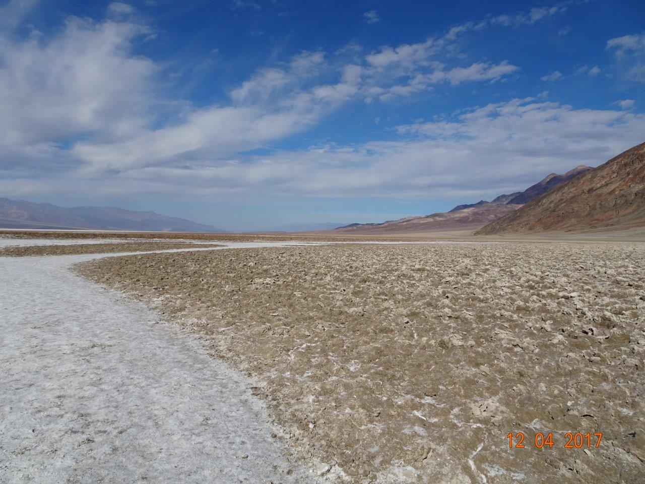
The paved sidewalk goes out so far, but then there is a very long area where people's feet have pounded the rough salt area smooth and hard.  It looks wet, but is pretty dry right now.

As I said, there is water in Death Valley, but this water is extremely salty, hence this being "bad water basin."


This area is the lowest point in Death Valley. 

Who says the desert is ugly?

The early travelers in this area were happy to harvest salt from this and other areas to use to preserve foods, especially meat.


Heading back to the campground.  In the distance is a fancy hotel:  The Inn at Death Valley.  There is a restaurant and even a pool there.  Guess not everyone carries their home around with them all the time, so occasionally they have to stay in a hotel, while I never even have to pack a suitcase! 


Down the hill and around the corner is the Furnace Creek area.  There is a golf course here, ranch, gas station, visitor center, and campground. 


The old 20-Mule-Team borax works are about two miles past the campground, so I headed there.
I had not realized that the mining was done almost entirely by Chinese workmen.  And, they worked all year, which means in 120+ degree weather.  They scooped up the white borax and salt mix that formed here and hauled it to the processing plant, where it was purified so as to take up less room in the mule train carts.  It had to be horrible work for very little pay.


Pretty area and easy parking for my motorhome. 

These are the remnants of the processing plant. 


The processing plant from below. 

Not sure what these nearby buildings were. 


There were several mule trains, but this is one of them.  The end car was always a tank full of water for the mules and the humans. 


The small group listening to the ranger were VERY happy to be done and able to leave. Why?  Temps were in the low 60s, and the very cold wind was at least 25 MPH.  Brrrrr!   Death Valley can be very cold in the winter with nighttime temperatures in the low 40s, which is what they have been lately.  Supposed to warm up to daytime temps in the 70s and night temps in the 50s in a couple of days.  

12/3 Death Valley, Furnace Creek Campground

It was a great drive into Death Valley over the Panamint Mountains, and then from the northern part of Death Valley to the Furnace Creek area further south. 


Now, honestly, what would it have taken for the road construction crew to run a road grader back and forth a few times before they laid down the asphalt?  This stretch reminds me of a roller coaster.  

 Nice view, and eventually the road does flatten out. 

Once in the park, it is still 30 miles to Furnace Creek.  There really is a creek here, but no water in it right now.  Surprisingly, Death Valley is not completely dry because if you know where to look in canyons, there are springs and water.  My GPS is off by a couple of feet, but here is the elevation as I get close to Furnace Creek.

 This is really a very nice campground, with very long campsites and pavement in good condition.  Also, nice is that there are full-hookups, meaning electric, water, and sewer hookups.  Only problem is VERY weak cell service, so internet will be a problem for me.  I am hooking up to Verizon's "extended" 3G service, which means it is using someone else's cell tower and that cell tower is quite a ways away. 

The campground is really more full than it looks in this photo.  A lot of campers do not arrive until later in the day.  

Only about a quarter of the campsites have full hookups, so many of the campers have to fill tanks with wastewater if they are in RVs.  And of course, tenters have to wash dishes outside--never allowed in bathrooms.  This is one of the nicest dish-washing stations I have ever seen.  

As is usual, I took the first day at a location off, meaning I just stayed at home and relaxed.  But, I did take some time for a short walk over to the visitor's center next door. 

Nice, big map at the entrance. 

Wish I could see some of these guys, but bighorn sheep hang out in the mountains and canyons. 


Back home in the late afternoon, as you can tell from the shadows. It is hard to adjust to the sun setting at 4:00 pm because of the mountains and season.  Am looking forward to longer days after the solstice that is coming soon.