Sterling State Park is located along Lake Erie in Monroe, Michigan. It is my favorite place to stay when I am visiting the Detroit area. There is always a nice view of the lake and a pleasant breeze.
This weekend it is extremely busy because of the Memorial Day weekend.
The view of the lake is nice.
The other nice thing about the park is the miles of paved bike and hiking paths.
The state park was built on marshland next to Lake Erie, and the bike paths circle several of the lagoons and marsh areas. The lagoons and marshes are a great bird nesting area.
This map shows my location on my bike ride. If you take the route that goes towards I-75 and underneath it, you will end up at a War of 1812 battlefield along the River Raisin. In actuality, it is the River Raisin delta that forms the marshes in the park.
Here is the River Raisin itself.
Here is a pair of Mute Swans with their babies. They are not native to North America and are considered aggressive to other birds.
You can see the campground on the other side of the lagoon. Lake Erie is on the other side of the campground.
A great blue heron and possibly some white herons. Bills are dark, and I cannot see legs, so I am unsure what these are. They look smaller than the great blue heron.
The smokestacks are from the Detroit Edison Power Plant. It is coal-fired and the low rumble you can sometimes hear is the only negative thing about the campground.
Saturday, May 23, 2015
5/20 Hooking Up My Motorhome
Because I am an older woman, I get a lot of questions about whether I have trouble hooking up my motorhome. Actually, it is amazingly easy, so I put a couple of very amateur videos showing the process.
http://youtu.be/qwH43GS9jN4
And here is how I put the two slides out.
http://youtu.be/3tu0evNgSow
I'll be adding something about dumping my tanks soon.
http://youtu.be/qwH43GS9jN4
And here is how I put the two slides out.
http://youtu.be/3tu0evNgSow
I'll be adding something about dumping my tanks soon.
Saturday, May 9, 2015
5/9 Battle Run Campground on Summersville Lake, WV
I got here after a long drive through freeway construction and on curving roads to discover they had no city water connections. Normally, this would not be a problem, but I have been having RV water pump problems, and without a water pump, I cannot get water out of my fresh water tanks. I did have several jugs with me and figured I could manage for one night, so I got set up.
Normally, with a water pump, you just set a switch inside to turn it on, and it starts running to pressurize the water in your system. For some reason, mine has been just running and running without priming or pumping water. I use the water pump when I am at a campground without hookups or on the road when I want to use my toilet or wash my hands, but lately had been bringing along a couple of gallons of water for toilet flushing. Very irritating not to have the pump run because it was new in December and cost me $300, and this was my third pump in three years!!! However, I finally decided to let it run longer than I had before, and after 25 minutes it finally started pumping water. Yea!
This is a pretty place, like most Corps of Engineering campgrounds are.
Got my bike out and went for a ride today to the dam that forms this lake. Here is the entrance sign to the campground. Beyond this point, I was on a road with no shoulder so I only went a couple of miles to the dam and a scenic view pullout. Had there been a bike trail or wider shoulder, I would have gone all the way into the town of Summersville.
This is the earth fill dam that makes Summersville Lake.
And this is looking from the dam down to the river that it blocks. Looks like you could do some whitewater kayaking here.
Normally, with a water pump, you just set a switch inside to turn it on, and it starts running to pressurize the water in your system. For some reason, mine has been just running and running without priming or pumping water. I use the water pump when I am at a campground without hookups or on the road when I want to use my toilet or wash my hands, but lately had been bringing along a couple of gallons of water for toilet flushing. Very irritating not to have the pump run because it was new in December and cost me $300, and this was my third pump in three years!!! However, I finally decided to let it run longer than I had before, and after 25 minutes it finally started pumping water. Yea!
This is a pretty place, like most Corps of Engineering campgrounds are.
Got my bike out and went for a ride today to the dam that forms this lake. Here is the entrance sign to the campground. Beyond this point, I was on a road with no shoulder so I only went a couple of miles to the dam and a scenic view pullout. Had there been a bike trail or wider shoulder, I would have gone all the way into the town of Summersville.
This is the earth fill dam that makes Summersville Lake.
And this is looking from the dam down to the river that it blocks. Looks like you could do some whitewater kayaking here.
5/7 Drive Through West Virginia
I ended up driving 233 miles today which is a lot for me in this big vehicle. The first 30 miles or so was curvy roads in Kentucky, then I had a 170 miles of freeway, with about 20 miles of stop and go construction. I thought I was free and clear after that, but had not counted on the 30 miles of very hills and curvy road through West Virginia to get to Summersville Lake. I did stop for a very few groceries and at Kohl's to get some new shorts, but the whole trip took me over 8 hours! Whew.
This would have been a pretty drive if I hadn't had to watch my driving so carefully around the sharp corners and through tiny towns. Plus, it takes a lot of effort to just steer this big vehicle, power steering or not. Very tiring. I much prefer roads with wider shoulders and not so many drop-offs on the side!
5/6 Fort Boonesborough SP, KY
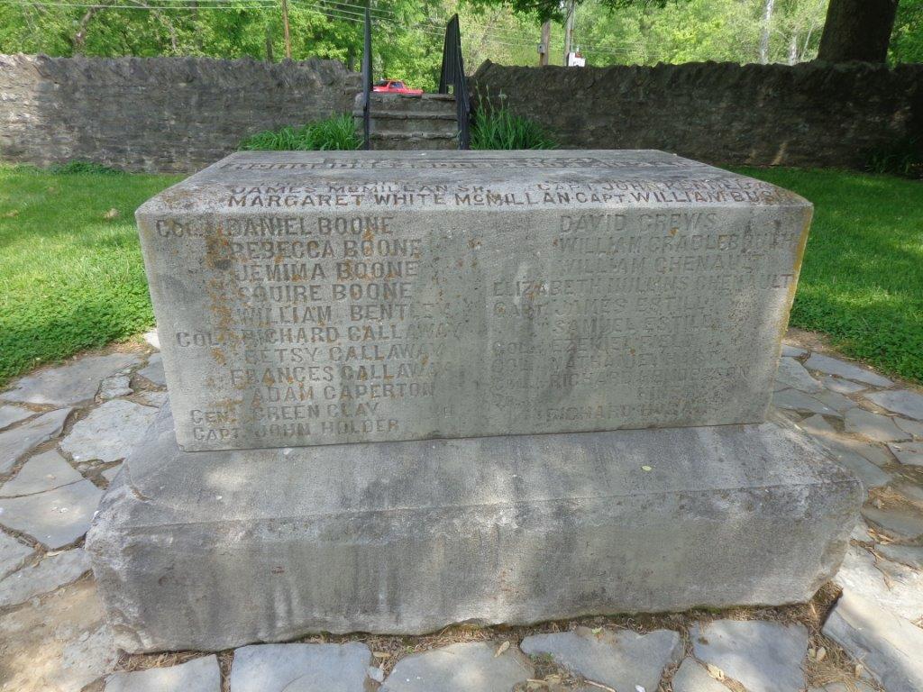
Not an impressive campground, but had electric and water and was open enough to get satellite TV, so I was happy. The state park is on the grounds of what used to be Daniel Boone's settlement and fort, so I drove the half mile down the road to see it. (Would have ridden my bike such a short distance, but there is a quarry next door, and the huge truck traffic was horrendous. Just too scary to ride a bike.)
First, I visited the original small fort built by the settlers. I was amazed at how small it was.
So, on to the bigger fort, which was a reconstruction done in 1974.
Most of the earliest settlers came by horseback because there were no roads for wagons, so the early dwellings were pretty basic. This one was titled "We just got here" and has a bed made of straw with little other furniture.
This dwelling was titled "We've been here a while so had time to make some furniture and get settled."
This was titled "We came later and brought some furniture with us."
This was the wood-workers shop. Some of the buildings had volunteer craftspeople and re-enactors, but I was there on a week day so it was not fully staffed.
The blacksmith's shop and forge was placed in the middle of the fort and outside because of the smoke and chance of burning something down.
Last photo. I was a very pleasant day for walking around the fort.
First, I visited the original small fort built by the settlers. I was amazed at how small it was.
So, on to the bigger fort, which was a reconstruction done in 1974.
Most of the earliest settlers came by horseback because there were no roads for wagons, so the early dwellings were pretty basic. This one was titled "We just got here" and has a bed made of straw with little other furniture.
This dwelling was titled "We've been here a while so had time to make some furniture and get settled."
This was titled "We came later and brought some furniture with us."
This was the wood-workers shop. Some of the buildings had volunteer craftspeople and re-enactors, but I was there on a week day so it was not fully staffed.
The blacksmith's shop and forge was placed in the middle of the fort and outside because of the smoke and chance of burning something down.
Last photo. I was a very pleasant day for walking around the fort.
Tuesday, May 5, 2015
4/30 Unicoi Scenic Highway & Hogpen Gap
I had been visiting some relatives in Helen, GA, for a couple of days, but left this morning for Tennessee. The road that goes northwest through the mountains is called the Unicoi Scenic Highway, and I have driven it several times. It is always very scenic, but it is also extremely curvy and steep.
You gain almost 4,000 feet over about 10 miles. At the bottom it is full-blown spring, with leaves almost completely out on the trees.
As it gets higher, it looks more like very early spring, with very tiny leaves on trees.
Here is the "official" rock/sign pointing the way to the trail and identifying north and south.
I walked a couple hundred feet down the road to where the trail crossed the road and continued on.
I walked up the trail a couple of hundred feet because I wanted to read some signs I could see. It is a very well-worn trail and a little hard to walk on because there were so many roots and rocks.
One of these signs points to Hog Pen Gap, and the other points to Tesnatee Gap. The rock on the other side of the road and down 200 feet said this was Hog Pen Gap, so I don't know why it is pointing somewhere.
Lots of things to trip over on this trail.
This sign is very worn, but it says "Raven Cliffs Wilderness - Chattahoochee National Forest."
Well, at least I can claim to have walked part of the Appalachian Trail!
You gain almost 4,000 feet over about 10 miles. At the bottom it is full-blown spring, with leaves almost completely out on the trees.
As it gets higher, it looks more like very early spring, with very tiny leaves on trees.
As you reach the top of a pass, there is a sign showing that the Appalachian Trail passes here. So, I had to stop. The elevation here is about 4,500 feet.
Here is a forest service sign identifying the trail. Note the water that someone has left for hikers.
Here is the "official" rock/sign pointing the way to the trail and identifying north and south.
I walked a couple hundred feet down the road to where the trail crossed the road and continued on.
I walked up the trail a couple of hundred feet because I wanted to read some signs I could see. It is a very well-worn trail and a little hard to walk on because there were so many roots and rocks.
One of these signs points to Hog Pen Gap, and the other points to Tesnatee Gap. The rock on the other side of the road and down 200 feet said this was Hog Pen Gap, so I don't know why it is pointing somewhere.
Lots of things to trip over on this trail.
This sign is very worn, but it says "Raven Cliffs Wilderness - Chattahoochee National Forest."
Well, at least I can claim to have walked part of the Appalachian Trail!
Subscribe to:
Posts (Atom)