Saturday, November 5, 2022

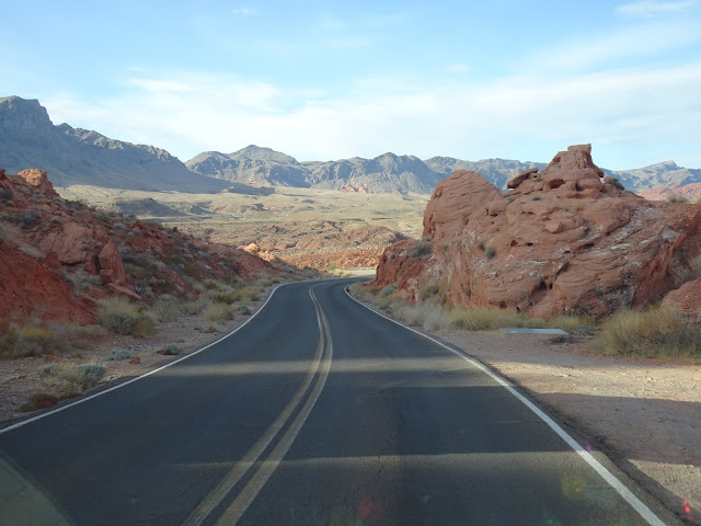
11/5 Valley of Fire State Park, NV

This is one of my favorite places in Nevada--huge state park with lots of red rock and fantastic views.  Also, small bands of wandering Big Horn sheep that visit the campground or can be seen along the roadways in the park.  I am happy to be able to stay here for the maximum 14 days allowed. 


I was happy to get a handicap spot--the last electric hookup spot in the campground.  This is a first-come, first-served campground, which means you cannot make reservations and just need to be lucky enough to get there as a site opens up.  (Note: This has changed for 2023, so you can now make reservations through the Nevada State Parks system.)

I had pulled in the wrong way, but before I turned around, I dumped off my "Site Occupied, Be Right Back" sign and put a tablecloth on my picnic table so other people could tell the site was occupied.  The camp hosts immediately stopped by and verified that I had a handicap parking tag.  Whew!

If I had not been able to get an electric site, I would have taken a spot with no electric service and then moved in the morning. 


 As you can see, the campground is circled by red rocks on three sides.  It was a beautiful day, a bit chilly but warm in the sun, so I went for a walk around the campground.  I met a lady staring up into these rocks and discovered that her son and three grandsons were climbing the peak on the right!! 


There was a relatively long and heavy rain yesterday, so a lot of places had sand washed away.  They were able to move sand back with a small bulldozer, but this spot was just marked so drivers would not go off the side.  


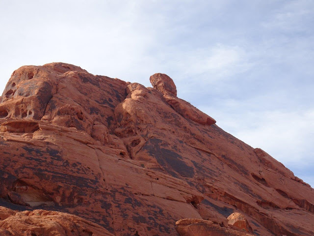
One thing interesting and a bit unnerving about this campground is the fact that the rock walls surrounding it are more than a bit crumbling.  There are several big rocks that look like they are ready to fall, such as the one below.  What you can't see in this photo is that there are campers just below it.  


Here is another likely candidate to fall in even a small earthquake.   Except this one is the size of a small house.


And the whole side of this cliff face looks ready to slip.  In fact, you can tell it has already slid a few feet, so it would not take much for it to slide all the way down.
 

As I was walking around, I noticed some Bighorn Sheep tracks in the wet sand.  Notice how one foot is closely put in the same space as another one.  These are so fresh, they had to be made this morning. 


It was fun following the tracks as they went directly through the campground!  I have seen the Bighorn sheep many times in other visits here, so maybe I will see them tomorrow.

This was on the sidewalk in front of the restroom/shower facility, so the sheep have definitely been here!!


I was told the Bighorns have learned to get a drink by turning on campsite faucets.  These levers are perfect for sheep noses!!   This is the double water hookup for my campsite, and I had not noticed before that each outlet has a cap that can be screwed on.  Wonder if it is there to prevent sheep from turning on the water?


Last time I was here in January, 2021, I had been worried about the thirsty sheep, but discovered that there were two "wildlife guzzlers" in the mountains in this 44,000 acre state park.  A guzzler is a tank and rain catchment system that is usually installed by volunteer groups so that rainwater is collected into underground tanks where it is slowly released to be available to thirst birds and other animals.  Here is an article explaining about wildlife guzzlers:  What's a Wildlife Guzzler?

 Here is a video showing animals using a guzzler:  Animals on Camera, Water for Wildlife

During drought periods, some organizations and governmental units have used fire-fighting helicopters to dump water into these systems.  Apparently, they are all over the western states.  This article was written a year ago about the Nevada Department of Wildlife filling up guzzlers in Valley of Fire:  Drought raises reliance on Nevada desert wildlife ‘guzzlers’

Tuesday, November 1, 2022

10/31 Some Random Photos Driving Through Nevada

A lot of people think Nevada is boring because so much of it is "bare" desert, except that desert is never completely bare and the mountains and valleys, even an occasional lake, presents some unique scenery.

I am headed to Las Vegas to spend a new weeks at a couple of my favorite places, but there are two ways to get from Oregon to Las Vegas.  The first is driving on I-5 through California and making a left turn at the bottom of the Sierra Mountains past Bakersfield.  The other, which I prefer, is to take the two-lane U.S. 395 from Susanville in the far northeast of California to Reno and then drive on along the east side of the Sierra Mountains.  This requires cutting west from Reno along I-80 and then exiting onto U.S. 95 at Fernley, NV.  This route takes you through Fallon, Hawthorne, Luning, Tonapah, Goldfield, Beatty, Amarosa Valley, and finally arriving at Las Vegas. 

Besides the scenery, the drive along U.S. 95 has little traffic, which is a positive.  A negative is that gas stations can be 50-60 miles apart, so you have to watch your gas gauge.  There also aren't too many RV parks, but I managed to stay nights at Hawthorne and Amargosa. 

Here are a few of the photos I took along the way, over three days of driving. Note the empty roads!!


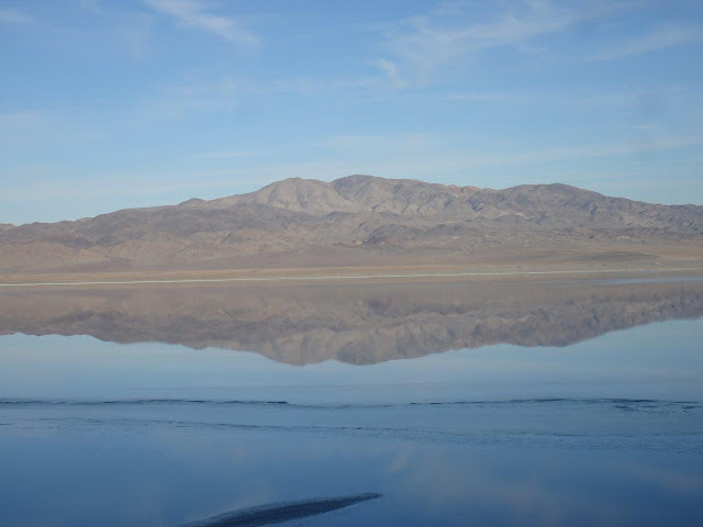
I noticed this lake, Lake Walker, in the distance, so I pulled over.  The water level was very low, but it was late afternoon and the sun was shining just right on the calm water.


Perfect reflection!!


Nice place to stop for a break.  I tend to take a half-hour or longer break after about two hours of driving.  This was a nice place to rest and take some photos of the lake. 


So, what are all these buildings far into the distance??


Ah!  This explains it.  This is a depot where ammunition and such things are stored.  Good place to store stuff in the desert since there are not a lot of people around. 


Monday, October 31, 2022

10/28 Merrill Campground, Eagle Lake, California

Eagle Lake is the second largest natural freshwater lake that is entirely in California.  Most of the "lakes" in California are really reservoirs because they were contructed with dams, but there are a small handful of "real" lakes in California, and this is one of them.  

If you have never heard of Eagle Lake, it is because it is way up in the far northeast corner of California, about 15 miles north of the town of Susanville.  It is also northeast of the Lassen National Park area.  I have been here before and love the big trees.  I was told, however, that the lake has some of the best rainbow trout in the state.  

It was VERY cold here, with nighttime temps dropping to about 22 degrees.  The state park, has three types of campsites--full hookup, partial hookup, and no hookup, so lots of choice.  

Here are some photos of the drive to the lake and the campground. 


Not a lot of traffic, as you can see, but there was a very large area of burned-over land.  I need to look up the name of the fire.   Just checked it out, and this was the 8,000 acre Hog fire in 2020. 


The road from Susanville is steep and winding, but I was able to take this quick photo of the lake in the distance. 


I had a partial hookup site because I was only there for one night.  Partial hookup means electric and water, but no sewer hookup.  

You can tell how big the trees are by comparing them to the size of my motorhome.  I will be back here again. 

10/23 More Gorgeous Oregon Coastline!

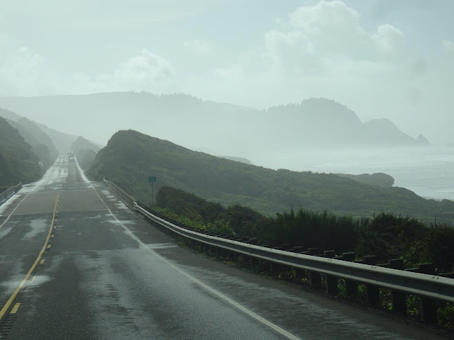
I have taken a lot of photo of the Oregon Coast, but I could not resist stopping and taking more photos in the fog and then when the sun came out.   No need to say anything more about them, other than the area south of Yachats is some of the prettiest coastline.

It was windy today, so the ocean was NOT very Pacific!


Finally, the sun came out. 


Sunday, October 23, 2022

10/18 South Beach SP, Newport, OR

This is a very nice state park close to the beach.  You do need to walk about 1,000' to get there, but there are several, nice, paved paths for walking or bikes.  I have been here before a couple of times and was planning on riding my bike around, but the weather has been really cold and windy, plus, I cannot find my bike key, so I have been spending a lot of time indoors catching up on reading and some chores. 

I don't know if it is because October is off-season and they are short of camp hosts and rangers, but the last several campgrounds have had absolutely no one manning the entrance booths.  Day use people need to fill out a form and put money in a slot, but campers with reservations have already paid for their sites, so we just need to go to our sites and get set up.  Nearly always, there will be a tag on the site with our names on it. 

This is my campsite, but I am not going to pick site B14 again because I had trees on both sides of me, which made it tough to get into.  Notice that the roof and rear of my vehicle is clear of trees, however.  I always choose sites where I can get a clear satellite view to the south so I can watch TV!!


Tuesday turned out to at least be sunny, so I decided to go for a long beach walk since I cannot ride my bike due to my missing bike key. 


The entire coast in the Northwest is wet and usually cool, so a lot of moss grows.  It reminds me of a lot of places in Florida where you also get moss on trees.

Finally, the beach!! 

This is looking north towards the jetty that protects the south part of the harbor entrance.

And this is looking south.  Not much this way for several miles.

I like walking during low tide because the hard sand is easier to walk on and you can see stuff that washes up better.  I am getting closer to the jetty, which is about 3/4 of a mile away.

 
The white thing is a large fishing boat that I saw in the Newport harbor the other day when I drove over the big bridge. 
 

Wish I could find the name of this ship so I could look it up and see what it is doing.

The large ship in the distance along with a smaller fishing boat.

A view standing on the jetty looking out in the ocean.

A lot of people use the jetty for fishing or just walking.  Lots of warning signs!

At this point, I decided I would walk to the main highway and stop at the nearby fish market.

It was a long walk along the roadway that goes from the jetty to the main highway, but I got to take this photo of a fishing boat and the lighthouse in the distance.


My walk to the fish market was a lot longer than I planned on, but here are some crab pots. 

Whew!  I estimate that so far I have walked over two miles, but I arrived at the fish market and ordered a fish sandwich and some clam chowder to take home. 


At this point, even after resting and having my fish sandwich and a Coke, I was really tired.  I did a lot of walking in London, but I am really out of shape.  I tried to get an Uber, but ended up walking another mile and a half to the state park!!  I may not be able to walk tomorrow because my muscles are already complaining.

I did want to post this sign I noticed in Newport a couple of days ago.  Somebody, at least, has a sense of humor.  I have not checked to see if U.S 20 actually does go to Boston!!

I have a pint of clam chowder which I am looking forward to for a couple of dinners or lunches in the coming week!!