Monday, October 26, 2020

10/20 Lake Powell

 Lake Powell was created in 1963 with the completion of the Glen Canyon Dam on the Colorado River.  It is a beautiful lake, but has been controversial from its inception.  As it filled, it inundated several places that were historical both to Native Americans, but also to U.S. history.  If you are interested, here are a couple of articles on the history of the area before the lake was formed. 

It took until 1980 for the lake to completely fill, and I remember taking my kids there around that time period.  We rented a speed boat and were able to go almost anywhere on this huge lake.  Now, the lake looks sad to me because it is just a remnant of what the lake looked like then.  It provides water to Las Vegas and Phoenix, as well as a lot of other areas.  And it is required to dump water into Lake Mead, which is also much, much lower than what they call "full pool."  It is more obvious on Lake Mead, but you can see the "bathtub ring" indicating where the water level once was.  

In fact, since both lakes are so low, some people have suggested destroying Glen Canyon Dam and allowing all the Lake Powell water to go to Lake Mead.  That would make an awful lot of people unhappy because this lake is extremely popular with thousands of boaters.  It would also make the town of Page, AZ, unhappy because the town really only exists because of the recreation taking place on the lake.  

I have been to Lake Powell several times, but I ended up here this trip because they closed the North Rim of Grand Canyon and cancelled my campground reservations!  The problem is that both rims of the Grand Canyon get their water from Roaring Springs, about halfway up the Canyon on the North Rim.  Except, the pipes broke on the North Rim side this past July, and they are still working to repair them.  Actually the pipes to both rims break fairly often, but this time it was much more serious.  Here is an article and photo of the break:  https://www.williamsnews.com/news/2020/jul/22/north-rim-implements-water-conservation-measures-a/

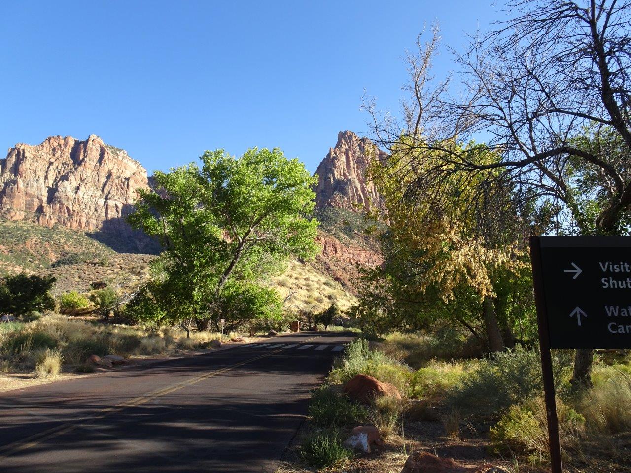
Anyway, here are some photos I took of the approach to the lake and the campground.  You can just see some tiny glimpses of the lake in the first photos.


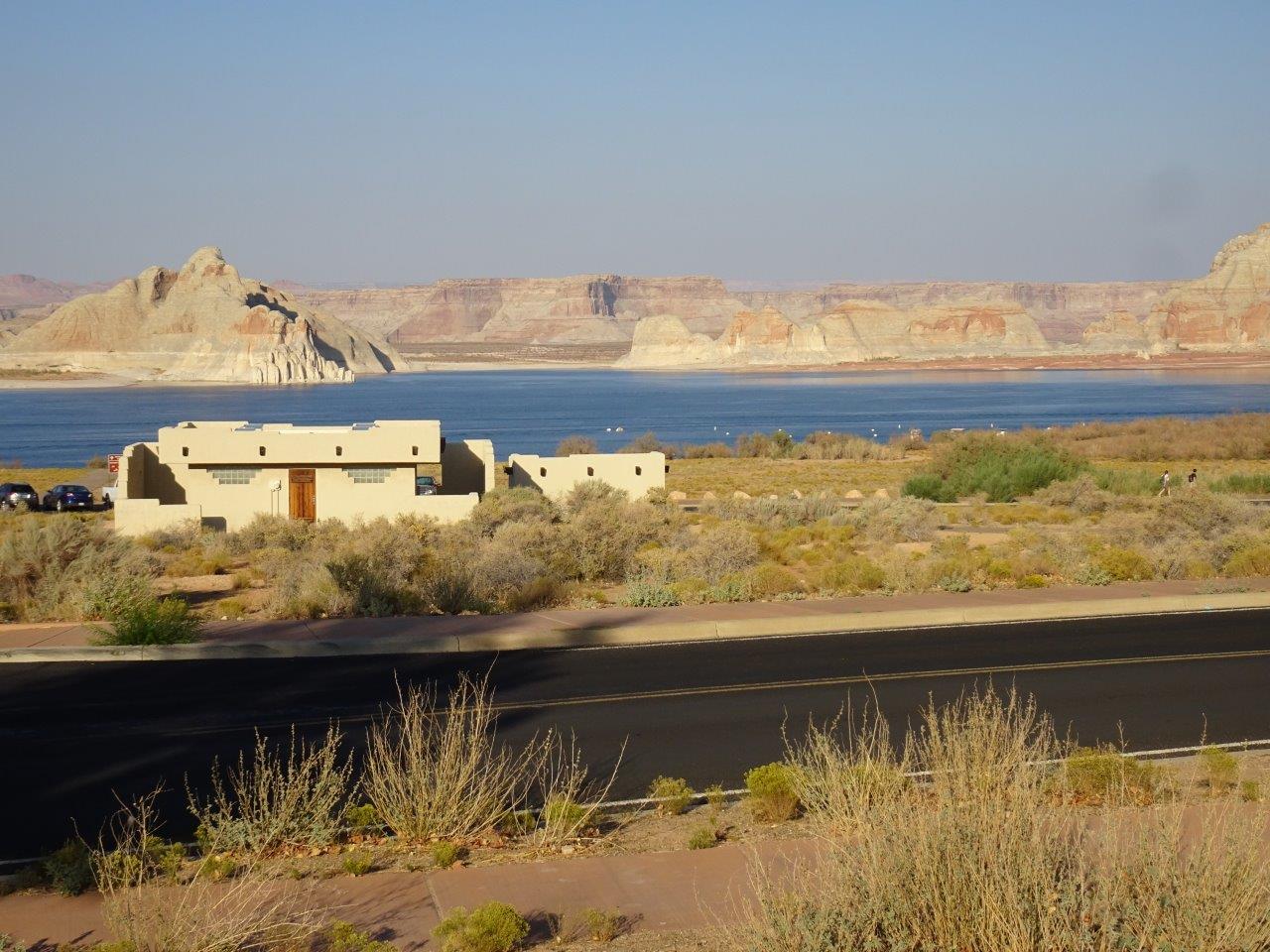
Can you see the original lake level in the bathtub rings on the mesas on the left?  The lake is now almost 100' below the "full pool" level.  And when we were here in around 1978, most of the flat area you see in the distance was navigable lake.


Sad to see the lake so low. 


Wahweap campground is very nice, with paved roads, paved RV spots, and full hookups, but it is a bit over my usual budget.


Again, you can see the lighter colored "bathtub ring" showing the original lake level. The white building is the restroom facility for the day use area.


Sunday, October 25, 2020

10/18 Pipe Spring National Monument

 This is not a big place, but it is not too far off the main highway and worth an hour stop.  The visitor center was closed, but there was a ranger at the entrance passing out pamphlets and directly us to the historic Pipe Stem  spring and farm area. Basically, this is a spring that came out of the base of the hill you see in the distance.  It was heavily used by Native Americans. 

However, after Brigham Young settled Salt Lake City, he sent Mormon "pioneers" out to other areas to find places for Mormons to settle.  They chased off the Indians and built this farm. 


An interesting cactus.  I will have to look up its name.

To prevent the Native Americans from using the spring, the Mormons built this sort of fort around the spring.

There were also outbuildings where some settlers lived and at times were used for barns.

The walls are original, but they had to reconstruct the ceilings. 

Pretty sturdy buildings!

This is the entrance to the fort around the spring.

The water from the spring has been piped into the building and entered this trough.  Originally, there was a much heavily water flow, and this room was used to store cheese and things like meat produced from the farm.

This shows the length of the trough.  After the water left the building, it was used for irrigation and for cows that produced the milk for the cheese.


There was more to the story of this farm and fort, such as it having rooms for rent where Mormons hid their plural wives while they were pregnant and the first telegraph station in Utah.

Below is a depiction of how the farm might have once looked.


Tuesday, October 13, 2020

10/13 Zion National Park, UT

 It has been amazing how busy both Bryce and Zion National Parks have been.  I had expected to spend a nice, quiet, relaxing two weeks here, but the campground has been full every night.  As with Bryce, there are shuttles here, but most of the seats have been removed and here at Zion, you need to purchase a shuttle pass for $1 per person in advance.  

Watchman Campground here at Zion is one of my favorites. First, the sites are big and paved, plus they all have electric service.  Second, if you get your reservations in very early, as I do, you can get a site along the river and close to the Visitor Center and shuttles. The dump station and water fill is close by also.  My site is along the river and the little paved walkway that goes to the visitor center.  Cost is a real bargain for seniors at $15 per night.  If you are over 62 and have a senior pass, entry to all national parks is free.   

 Where else can you get a view like this for $15 per night???   Also, because this site is fairly open, I have good satellite reception and good Verizon service, so I can get a strong internet signal using my mobile hotspot.

The town of Springdale is right across the river, but it is not very noisy, and being a quick walk across the little pedestrian bridge makes it easy to go to the post office or a market.  Lots of restaurants and hotels, also. 

My plans for these two weeks were lots of rest and relaxation, with some cleaning and reorganizing some of the stuff I have in my underneath storage "basement."  Also, been grading papers for the college class I teach.  And, whenever I look out of my windows, I see this:

A few more photos of the campground.  There is also a non-hookup campground nearby, but it does not have paved sites or electricity.  Mostly, it is full of tenters.


Just a few hundred feet away are the visitor center and shuttles. 


Because of the very limited parking, you are not allowed to take a private car up the valley, so you must use the shuttles or ride a bike. 

The shuttle lineup system reminds me a little of Disney World without the constant music playing. 

This is a model of the valley.  Today I will be headed to the very end, where The Narrows is located.  The valley narrows to almost nothing here, and most times, you can wade up the river another mile or so.  Only problem is that the Virgin River right now is contaminated with a toxic Cyanobacteria.  There are signs all over telling you not to let pets drink the water and to wash them off immediately if they go into the river, however, there are still lots of people wading in the river--they are NUTS!! 


Onto the shuttle, and away I go.  This is the stop at the far end of the valley at the start of the Narrows trail. 

Just beautiful huge cliffs wherever you go in Zion. 

A mule deer resting a few feet from the path.  None of the deer look very healthy, by the way.  You can see their ribs and their fur is mangy-looking.  I need to ask one of the rangers about them.


The entire length of the trail is handicap accessible, even by wheelchairs. However, it was a struggle for me at this altitude because it was slightly uphill.


This was close to the end, but I think I missed taking any photos there.  Rested a while and headed back to the shuttles.


Time to get off the Disney World Ride at the visitor center and go home.

 
This is the paved walkway along the river that goes past my campsite. In fact, you can just barely see my rig way down at the end. 


Home, sweet home!   I did not realize it, but the Narrows trail was 2.2 miles long, round-trip, which explains why all my muscles are so sore and I am so tired.