I headed to downtown Santa Fe today because I had heard there was a great farmer's market, and I was not disappointed. Even though it is early in the season, there was a lot of spring greens such as lettuce and early vegetables. I bought some tiny white turnips, pink radishes, and baby bok choy.
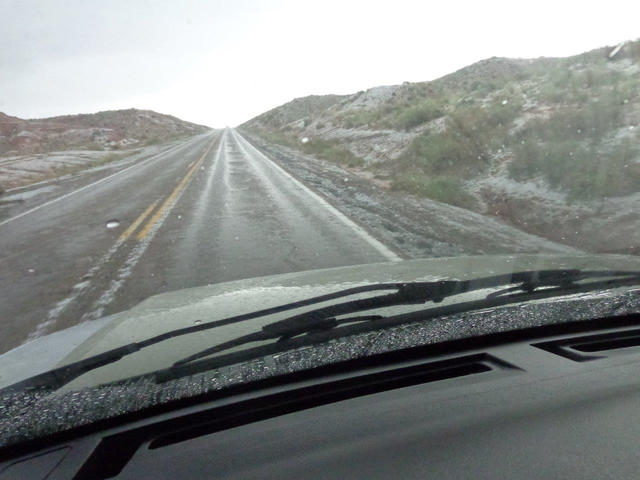
Cochiti Lake is about 5,500' in elevation, but you climb up to 7,000' when you drive the 30 miles into Santa Fe. Even though this is New Mexico, and it ought to be hot because it is so far south, the altitude means that those mountains in the distance recently had skiers zipping down them.
The next few photos are of the farmer's market. This area is a bit of a yuppie community, so there were quite a few high-end vegetables.
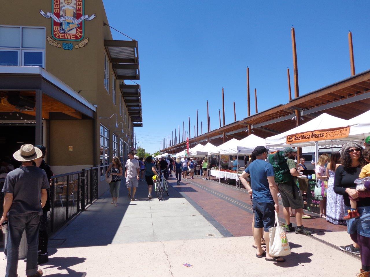
Obviously the farmer's market is in the rail station area. There is a commuter train from Albuquerque a couple of times a day.
Would you believe the things on this building are completely flat? The shadows are so realistically painted that you would swear they were real.
After the market, I had really wanted to go to the historical museum and walk around downtown, but I had parked my vehicle on the street in a really iffy neighborhood and could not get into the only parking lot in town that allows big vehicles.
Also, streets in Santa Fe are extremely narrow and the crowds were huge because of some sort of family bike ride that day, plus a low-rider car show, so after circling around a bit and barely being able to make tight turns and squeeze through streets, I headed home and breathed a few sighs of relief. This was one time I wished I had had a towed car with me.
Tuesday, May 24, 2016
Saturday, May 21, 2016
5/20 What Makes an Ideal Campsite? Cochiti Lake Recreation Area, NM
I arrived at one of my favorite places late yesterday--Cochiti Lake Campground, built and operated by the U.S. Corps of Engineering. The Corps of Engineering builds hundreds of dams and lakes across the country and nearly all of them have recreation areas built into them, as well as campgrounds. A real plus for people over 62 like me is that we get half off the camping fee, which adds up over a year. In addition, they are nearly all well built and very well maintained, especially compared to most state parks.
This is one of my favorite campgrounds. What makes it ideal for me? First, it has a view. I like long views with mountains and lakes in the distance, and this place has both. Also, I picked a site on a hill so I get a good view of everything.
I don't tow an extra vehicle, but if I did, I would have a separate spot to park it.
My site is on a curve, but it is still very large. I am parked at the back of the site and also have enough room to step out my door while staying on the pavement.
And each site has a covered picnic table on a cement slab and all are in good condition. A real plus is the solar powered lamppost! Have never seen one of those in a campground before, but here, every site has one.
OK, new subject. when I bought my motorhome, one of the selling points was this large corner kitchen storage area. I keep my nesting pots with their lids, teakettle, and a ton of plastic containers. I use a lot of these containers because I often make a large batch of something and then freeze portions for days when I just want to heat something up.
Lately, things keep moving around and rattling as I drive down the road. When I stop and open the door, everything falls out. So a couple of weeks ago, I cleaned it out and tossed unneeded stuff. Yesterday, I picked up some non-slide liner and also got another small shelf unit. Today I put it all together. So this is the BEFORE picture. I am driving to Santa Fe tomorrow, so will see how everything stays in place when I come back.
This is one of my favorite campgrounds. What makes it ideal for me? First, it has a view. I like long views with mountains and lakes in the distance, and this place has both. Also, I picked a site on a hill so I get a good view of everything.
Next, the sites are well spread apart, so I do not have close neighbors.
I don't tow an extra vehicle, but if I did, I would have a separate spot to park it.
My site is on a curve, but it is still very large. I am parked at the back of the site and also have enough room to step out my door while staying on the pavement.
Very importantly, I have 5 bars on both my Verizon cell phone and jetpack or mobile hotspot! Yea! Strangely, a lot of COE parks and also Indian reservations (which this is next to) have excellent Verizon service.
Also, I have electric and water service, and the hookups are not rusted and ancient, meaning they actually work!
And each site has a covered picnic table on a cement slab and all are in good condition. A real plus is the solar powered lamppost! Have never seen one of those in a campground before, but here, every site has one.
OK, new subject. when I bought my motorhome, one of the selling points was this large corner kitchen storage area. I keep my nesting pots with their lids, teakettle, and a ton of plastic containers. I use a lot of these containers because I often make a large batch of something and then freeze portions for days when I just want to heat something up.
Lately, things keep moving around and rattling as I drive down the road. When I stop and open the door, everything falls out. So a couple of weeks ago, I cleaned it out and tossed unneeded stuff. Yesterday, I picked up some non-slide liner and also got another small shelf unit. Today I put it all together. So this is the BEFORE picture. I am driving to Santa Fe tomorrow, so will see how everything stays in place when I come back.
YES! I just got back from driving 60 into Santa Fe, and when I came back everything in this cabinet is in exactly the same place. Yea!
5/19 An Interesting Rest Area
Actually, this was not even a real rest area along I-40 in New Mexico because it was only a parking spot for trucks--no restrooms.
But as I pulled in, I noticed this sign and got out and did some more looking. Wow! 1692 got my attention.
This is the group of homes the sign was referring to, but it is across the freeway.
Because it is located on a hill, the architecture of the buildings certainly does make you think of an ancient Native American village. And note the Spanish church in the middle.
I found this government: https://www.nps.gov/nr/travel/route66/pueblo_laguna.html. It is well worth opening and reading!
This web site is owned by the pueblo itself and also interesting, even though the history section is empty. http://www.lagunapueblo-nsn.gov/Default.aspx
Found another article online with more history: http://what-when-how.com/native-americans/laguna-pueblo-native-americans-of-the-southwest/
So the lesson to be learned here is to stop and look at local things as you travel. I know I have been on this interstate and completely missed this before.
Friday, May 20, 2016
5/18 Canyon de Chelly National Monument
This is a wishbone shaped canyon valley that has been occupied by Native Americans for many centuries. It is now a national monument, but the Native Americans still live on the canyon rim and in the canyon floor much as their ancestors did.
My goal today was to drive from Page, Arizona, to Gallup, New Mexico, which was about 260 miles. I was headed to a favorite campground near Santa Fe, which I will post about in a couple of days. However, I had completely forgotten that my route went past Canyon de Chelly, which is pronounced "shay" by the way. Way back in 2011 before I started motorhoming, I had visited this place in a rental car and had taken a tour down to the valley. Tours are allowed only in Native American vehicles or by very difficult to get special permissions. In other words, individuals cannot drive, hike, or even rock climb into the canyon.
This is what it looks like.
The rim is high desert and very, very rocky. You can see why it would be difficult to farm here, although there are farms scattered about. Mostly they seem to raise horses and sheep.
This is the first peek we get on the South Rim of the relatively lush canyon below.
It is a long way down here, but you can see how many trees there are and how green it is. Some of the trees are planted and provide the residents with peaches and apples. The horses and sheep get water from a river that flows much of the year. In addition, the people who live here dig ponds that hold water all year.
Also, note the storm clouds in the distance.
Here is a good view of the river. You might see some dark dots that are horses.
And the storms continue to gather. Check out this video I took: https://youtu.be/pZ1drBFFXSk
This view shows farther down the canyon.
What a beautiful place to live. In the visitor center, the lady said that many families live in the canyon only during the summer because it makes it easier for the kids to get to school.
These next three photos were taken a few miles closer to where the two halves of the canyon join.
The rain finally poured down. I took this photo of the pools in the rocky area next to my motorhome, where I was huddling waiting for the rain to stop. Finally, I gave up and decided to return another day.
Check out the car in the ditch off to the left. Reminds me of Michigan!
My goal today was to drive from Page, Arizona, to Gallup, New Mexico, which was about 260 miles. I was headed to a favorite campground near Santa Fe, which I will post about in a couple of days. However, I had completely forgotten that my route went past Canyon de Chelly, which is pronounced "shay" by the way. Way back in 2011 before I started motorhoming, I had visited this place in a rental car and had taken a tour down to the valley. Tours are allowed only in Native American vehicles or by very difficult to get special permissions. In other words, individuals cannot drive, hike, or even rock climb into the canyon.
This is what it looks like.
The rim is high desert and very, very rocky. You can see why it would be difficult to farm here, although there are farms scattered about. Mostly they seem to raise horses and sheep.
This is the first peek we get on the South Rim of the relatively lush canyon below.
It is a long way down here, but you can see how many trees there are and how green it is. Some of the trees are planted and provide the residents with peaches and apples. The horses and sheep get water from a river that flows much of the year. In addition, the people who live here dig ponds that hold water all year.
Also, note the storm clouds in the distance.
Here is a good view of the river. You might see some dark dots that are horses.
And the storms continue to gather. Check out this video I took: https://youtu.be/pZ1drBFFXSk
This view shows farther down the canyon.
What a beautiful place to live. In the visitor center, the lady said that many families live in the canyon only during the summer because it makes it easier for the kids to get to school.
These next three photos were taken a few miles closer to where the two halves of the canyon join.
Here is an active home.
The rain finally poured down. I took this photo of the pools in the rocky area next to my motorhome, where I was huddling waiting for the rain to stop. Finally, I gave up and decided to return another day.
As I left Chinle, the town near the monument and headed south and then east, I noticed a car flashing its headlights at me. This was what they were trying to warn me of, I assume. Here, the rain had fallen as wet snow and hail. There was no place to stop or turn around, so I had no choice but to drive up this steep hill with slush on the road.
Check out the car in the ditch off to the left. Reminds me of Michigan!
Thursday, May 19, 2016
5/17 Grand Canyon Tusayan Ruins
For some reason, I missed this on my several previous trips to Grand Canyon. It is located on the east entrance, which may be one reason.
This was a small village of about 16 people that was occupied about 800 years ago. There is a small, but very nice museum and a short walk around the ruins. Most is self explanatory.
The top of this is cut off, but it says "Large Kiva" which is a ceremonial building.
This was a small village of about 16 people that was occupied about 800 years ago. There is a small, but very nice museum and a short walk around the ruins. Most is self explanatory.
The top of this is cut off, but it says "Large Kiva" which is a ceremonial building.
Subscribe to:
Posts (Atom)